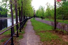
| View West along North Bank Des Seigneurs Locks in distance |
|---|

|
Roger Kenner
Montreal, Qc,
Canada 2003
[Early Days] [1999: Before Construction] [2001: In Construction] [2000: Post Construction]
[Many items have been suppressed in this Lite Version]
Even as late as 1999, not much had changed along this section from the original plans of the Canal Bike Trail. The former basins along the north side were already gone, partly occupied by the huge Canada Post plant. Of course, the Pont Guy-Bridge never materialized, nor did the 'Halte Wellington'. The plans called for a footbridge at Wellington. This was never built. But in the 1990s a vehicle bridge replaced the Wellington Tunnel.
The map below shows the area just prior to construction, at about the time when I took the photos below. The only significant changes from the time I first rode by this area were the rebuilding of the old Canadian Switch & Spring plant into the Agramont complex and the building of the new Tristan-America building. Perhaps, very early on, the Lofts Corticelli has not yet been completed, but I do not remember.
In the 1980s, my main eastern entrance and exit from the Canal was just west of the side basin on the north side, where a spur of the path led up to William Street. I would take William to Guy and climb up to Concordia.
| View West along North Bank Des Seigneurs Locks in distance |
|---|
|
|
| View of Inlet at Pointe des Seigneurs |
|---|

|
Past the Wellington Bridge, the trail continued along behind the Canada Post Complex and then its parking lot, across ground that had once been a series of unloading basins (See Historical).
At the western end of this stretch was an old inlet. Historically this inlet had been the outlet of a major hydraulic canal, and formed the northern side of Point des seigneurs. At this point, it was simply a stagnant body of water, overgrown with trees.
The trail split at this point, with a spur heading off northwards to join the street. During the 1980s, it was often at this point that I joined and left the Canal, on my way to and from work.
Continuing onwards, the trail crossed the inlet on a small, wooden footbridge (seen in the background).
The abandoned Redpath Sugar Complex can be seen in the background
| Footbridge over Inlet at Pointe des Seigneurs |
|---|

|
Swinging around the corner coming off the bridge, there was a sharp rise as the trail climbed to the level of the next reach. It was this rise which had been at the origin of the 19th Century hydraulic development of this area.
| North Bank approach to Des Seigneurs Locks |
|---|

|
| Redpath Sugar Complex |
|---|

|
The trail along the south bank continued along, first past the newly refurbished factory complex, and then past the ruins of the Redpath Sugar Refinery. The right-of-way that the trail followed had, in times past, been a street called 'Canal Street'.
Once past the refinery, there came a sudden rise, at the top of which was a basin leading inward and separated the Redpath ruins from the newly renovated factory condominiums. A small footbridge led the trail across the mouth of this basin.
| View to footbridge on South Bank From Des Seigneurs Locks |
|---|

|
| East from Des Seigneurs along South Bank of Canal |
|---|

|
Once at the lock complex, wooden footbridges led across to the north bank. The trail along the south edge had been blocked many years earlier, after complaints by the residents of the condominiums.
The old lock complex was an official 'halte' along the trail. The first channel was an overflow, with a cofferdam blocking the water at the head. Then there was an island, with benches for sitting and bike racks to rest the bikes. Finally, another footbridge led over what was left of the actual lock channel, but was at that point just a spillway (although, in historic photos, the purposes of these two channels was reversed.)
| Back across the footbridge at Des Seigneurs Locks |
|---|

|
| Control Gates at Des Seigneurs Locks Note beginning of construction |
|---|

|
Note at the left-hand side of the picture the almost completely rotted away wooden locks
| Spillway at Des Seigneurs Locks |
|---|

|
| East down Canal from Des Seigneurs Locks |
|---|

|
To continue onward, one passed under the roadway in a small bicycle underpass, and then swung around in a wide circle, to cross the bridge on its western side.
| Under the Tunnel at the Des Seigneurs Bridge (This view is actually towards the east) |
|---|

|
There was a wide, steel-plated expanse on the outside of the bridge structure. For the cars, the bridge floor was an open steel grating. The bridge had at one time been a drawbridge. Earlier photos show a swing bridge at this point. Hence, most likely, the centre 'island' in the lock complex. It must have been replaced with a drawbridge at some later point.
| Crossing the Des Seigneurs Bridge |
|---|

|
| Canal View West from Des Seigneurs Bridge |
|---|

|
Standing on the bridge and looking west, one could see the Canal stretching onward, with straight banks on either side. Traffic along the north bank was still closed off, as there were working factories there, and a rail line which extended as far east as the Robin Hood Flour Mills.
The north bank had not always been so straight. Even as late as the 1950s, it was cut with inlets and basins
The bike trail continued along the south bank. In recent years, a new building was built at the corner of Des Seigneurs and St. Patrick. In the back was an open terrace where, for a while, they had a café catering to cyclists. Then one passed the ends of a couple of half-block long dead-end streets.
A back side and freight driveway of a warehouse building of moderate age then streched alongside the trail. At the eastern end an old, square brick chimney and boiler had been preserved. It can be seen in the 1930s photo, and appears to be all that remains of the old 'Consumers Cordage' complex that once occupied the site.
| East along Trail towards Des Seigneurs Bridge |
|---|

|
When I returned with my camera two years later, the whole Des Seigneurs complex was in the midst of major construction. The locks were being rebuild. The bridge was being raised several feet, to allow for the passage of boats underneath. The water level of the canal was kept very low.
| Des Seigneurs Locks: View East |
|---|

|
| Des Seigneurs Locks: Construction underway |
|---|

|
| Des Seigneurs Locks: Spillway |
|---|

|
| Des Seigneurs: Turning Canal |
|---|

|
The trail along the south bank was closed for nearly two years, between Des Seigneurs and the Wellington Bridge. One could only look on from the opposite shore. Meanwhile, the Redpath Refinery fell ever more into ruin. Large, gaping holes appeared in the roof.
| Redpath Sugar Refinery |
|---|

|
I passed by in the Spring of 2002, to see the work completed and the gleaming new locks awaiting the boat traffic which was soon to come.
| Des Seigneurs Locks |
|---|

|
Note in the upper-left of the photo, the new building that had been built at the corner of St. Patrick and Des Seigneurs.
| Des Seigneurs Locks |
|---|

|