(Taken on 1998 Trip)

Roger Kenner
Montreal, Qc,
Canada 2002
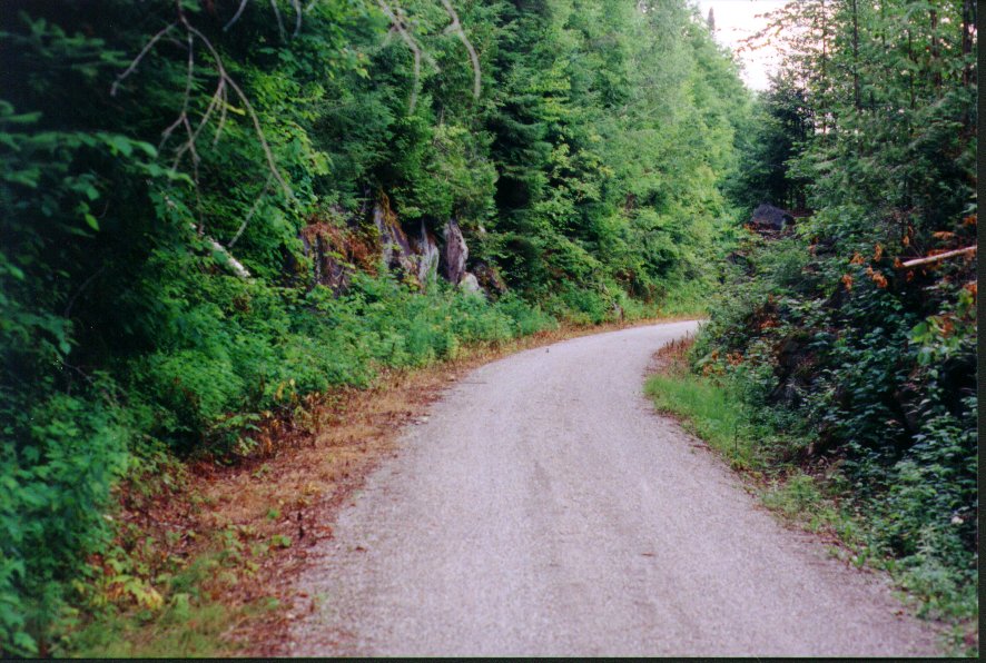
| Heading up the Road from Ste. Agathe |
|---|
|
|
At a certain point I came out of the woods and found myself following the trail across a marsh. A small creek wound its way back and forth through the grasses and reeds.
At 09:40 the trail passed under Hwy 117, crossing from its west to its east side. Here was the cavernous concrete tunnel in which I had taken refuge from the heavy rain back in 1995. Although it was sunny and warm outside, it was dark and quite cool within the tunnel. Coming out the other side, the trail curved to the north again, continuing straight along, through flat, marshy country. At one point it led right through the middle of a campground. Hwy 117 was just to the left, and often visible through the trees.
| The Underpass under the Hwy 117 | Map |
|---|---|

| 
|
| Open Countryside near the Summit |
|---|

|
| Along the 117, Just Past Rocky Curve | |
|---|---|

| 
|
| Coming into Lac Carré at the Summit |
|---|

|
The summit is at km 67 of the trail. I stopped there to chat with others take some photos of the quarry. I met four who were coming down from Mont. Laurier.
| At the Summit: 426 metres | Quarries at the Summit |
|---|---|

| 
|
| Quarries at the Summit | |
|---|---|

| 
|
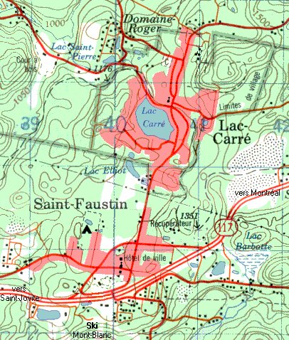
| Lac Carré Topographical Map |
|---|
|
| Lac Carré |
|---|

|
| Train Station at Lac Carré | |
|---|---|

| 
|
| Lac Carré |
|---|

|
Once again, the trail struck out into the woods. Down into the narrow canyon I went, and along by the lake and the dam, and soon I was passing by the Pisiculture at St. Faustin. It was 11:40, and still fairly cold out.
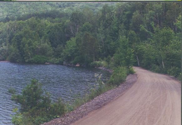
| The Trail Goes On | The Lake past the Summit |
|---|---|

| 
|
At 12:05 and km 80, I was riding along the Ruisseau Francais when I came to this odd bridge, by a lumber mill. It was both bridge and also dam, holding back a small lake. Although the scene was very interesting, I could not manage to get a good photo.
At 12:15 I was in St. Jovite. There was little to see at St. Jovite. The trail crosses the highway well on the eastern outskirts of town. The old train station has been removed to the town's main street, leaving only an empty park. The only thing around was my “regular” restaurant, just half a block towards town from the trail. I had eaten here in 1995, coming in soaked with rain as I had gotten caught in a downpour while returning from Mt. Tremblant. I stopped there again this time and had a tomato sandwich lunch for $5.
| St. Jovite | |
|---|---|
| View of Town | Bike Trail Crossing - Looking South |

| 
|
I was on my way again at 12:40. From St. Jovite the trail continues its long downhill from the summit a bit further, until it reaches the Pont du Diable, a high trestle over the Diable River. I reached this bridge at 13:00 and stopped for a short lookout.
| Trestle Crossing La Diable at St.Jovite | Looking down on La Diable from Trestle |
|---|---|

| 
|
From the bridge, the trail begins to climb once again, until it reaches Tremblant Village, on the shores of Lac Mercier. I reached the village at 13:30 and spent about ten minutes to looking around. I had spent quite a bit of time at Tremblant Village back in 1995, for it had been the end of my ride. I did not feel like there was much left to see. The whole area looked pretty touristy, so I continued on my way at 13:40.
| Mont Tremblant in the Distance | Train Station at Mont Tremblant |
|---|---|

| 
|
| Mont Tremblant Village | |
|---|---|
| 1998 | 1995 |

| 
|
Leaving the town, the trail hugs the edge of Lac Mercier as it goes nearly 3/4 of the way around. At first the hillside was quite steep, but soon it opened out and the landward side became lined with a series of fairly fancy houses.
| Looking out on Lac Mercier at Tremblant Village |
|---|

|
I soon came to the point where, in 1995, I had been forced by limited time to turn around. It felt good to be on trail which was brand new to me, no longer knowing what was coming up ahead.
| The Trail around Lac Mercier | |
|---|---|
| The 1995 Turnaround Point ... The Road Beckoned - I have Returned | |
| 1998 | 1995 |

| 
|
| Looking back on Tremblant Village from far side |
|---|

|
| Marsh at the Summit: 234 metres | |
|---|---|

| 
|
| Trail past La Conception junction |
|---|

|
| Bike Trail Map |
|---|

|
I passed the 100km marker at 14:45, and felt a sublime sense of accomplishment. The trail continued along in a straight and seemingly flat manner. In reality I was in a long, steady climb, which only became obvious to me when I looked back. I was in a wide, open valley, with farmer’s hay fields on my right and low, scrub forest on my left. I could see all the way back up the trail, for there was nary a curve.
| Entrance to Halte L'Achillée Millefeuille |
|---|

|
| L'Achillée Millefeuille | |
|---|---|

| 
|
| L'Achillée Millefeuille | |
|---|---|

| 
|
As I set out once again, the countryside remained flat, and was mostly hay fields as before. Low mountains all around defined the valley, which I would come to realise was the valley of the Red River. Although it still seemed flat, the trail had now had a slight downhill tilt, where earlier I had been climbing. The strong headwind remained my constant companion.
| Trail past La Conception junction | Trail nearing Labelle |
|---|---|

| 
|
| Train Station at Labelle |
|---|

|

|
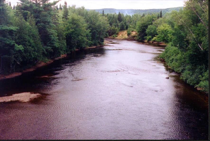
| Along the Rouge at La Macaza | Source |
|---|---|

| 
|
| Covered Bridge at La Macaza | |
|---|---|

| 
|
When I came to the trestle at La Macaza at 16:10, I recognized the location instantly. Here was the swimming hole I had come to many times in the late. One of my first outings with my brand new, blue Honda wagon had been to this spot in 1980. The scenery had completely changed. In those days the railroad line was in use. Only sparse, low bushes covered the area. The sandbar by the river was thick with cars and people, even with tiny camper trailers set up for the Summer. Now all was thickly overgrown with trees and deserted.
| Trestle La Macaza | |
|---|---|
| Road Across the Top | View of Old Swimming Hole Below |

| 
|
| Rapids beneath the Bridge | |
|---|---|

| 
|
I had not realized it, but I had crossed into the regional municipality of Antoine Labelle, and they had erected a series of historical plaques along the trail that would accompany me all the way to Mont Laurier (See the entire set in the Supplementary Sources section). When I noticed the first one, I was out in the middle of nowhere, but the plaque told me that where I was had once been Daoust Station. When the railway was extended past Labelle in 1904, it was here that the original station for La Macaza had been built. Later, in the 1920s, the station was moved into the town and Daoust became a switching yard. I continued on my way at 16:30.
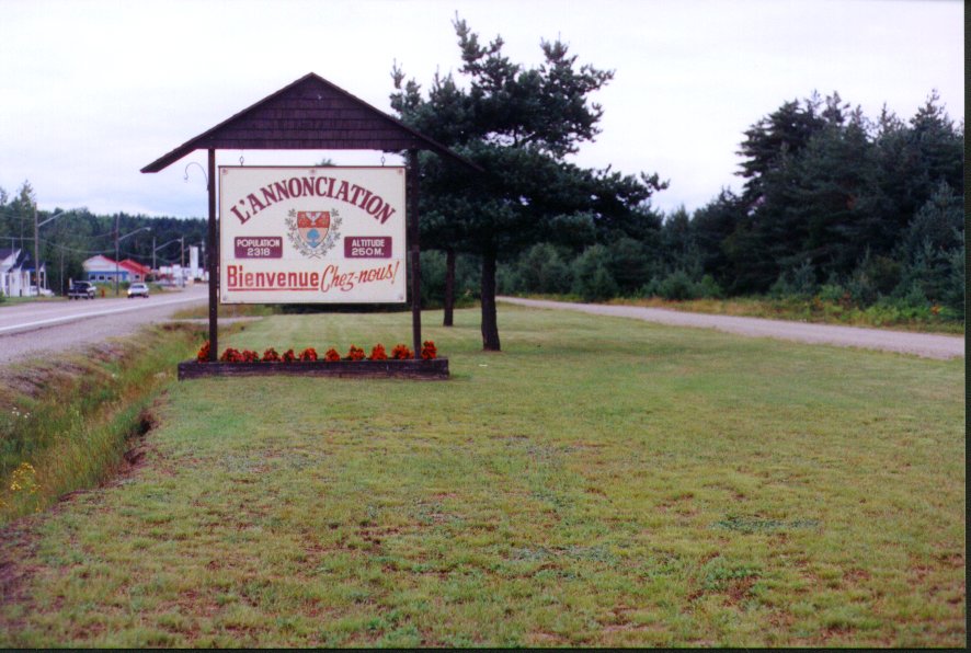
| L'Annonciation |
|---|

|
| Reaching L'Annonciation |
|---|
|
I rode to the centre of town, where, as I expected, there was an information kiosk. The helpful young girls directed me to the “cyclo-camping municipale”, which was just for cyclists. It was down at the lower end of town, away from the main road, and right by the Red River. In fact, it was at the back of the city park, behind the playground and baseball diamonds. I found the park attendant and paid my $5 fee and set up my tent, right on the river bank. There is no way I would have found the place without directions!
It was 18:00 when I got to the camping area, and by 18:30 my tent was up and I was ready to explore the town where I would be spending the evening.
| Camping |
|---|
|
| Camping at L'Annonciation |
|---|

|
It was cold when I left the restaurant. I put on my rain poncho for warmth and rode back down, in the fast fading light, towards the campsite. By the time I got there my area, under the trees and away from the faint park lights, was pitch black. I had to do everything by lamplight. I was worried about the food in my saddlebags, being so near the woods, so I took it out and put it loose into a plastic bag which I slung up over a tree branch a good distance from my camp.
I spent some quiet time sitting down on the beach by the river, whose current was very calm at that point. It was 09:00 when I climbed into my tent to retire for the night.
| L'Annonciation West part of Town | L'Annonciation East: City Park Campground |
|---|---|

| 
|
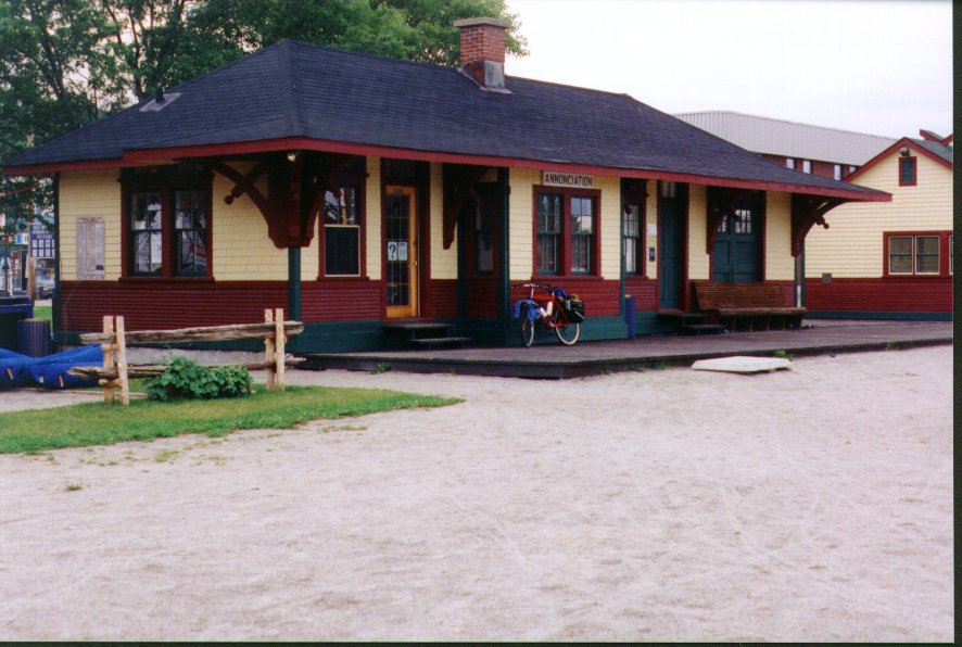
| Train Station at L'Annonciation |
|---|
|