(Taken on 1998 Trip)

Roger Kenner
Montreal, Qc,
Canada 2002
My second visit to the trail was in 1995. Sheryl had gone for several days down to Florida. Once my weekend with the kids was over, I had two free days left in order to take my trip. Though it was raining the Monday that I started, I went anyway, for that was my only window. That time I drove up to the starting point at St. Jerome and parked the car in the field by the train station before setting out up the trail in my full rain gearl. Luckily, the heavy rain soon abated, though both days would remain grey and drizzly, with frequent short showers. The rain was, in fact, a blessing for it allowed me to experience the trail in a new way. On that ride I got much further along the trail. I rode up as far a St. Jovite the first day, where I camped on the shores of the Diablo River after checking in with Sheryl, who was still in Florida. The next morning, I continued on as far as Mont Tremblant, where I checked out where the old lodge had been, and then rode a short ways around Lac Mercier, the lake on which the Village of Tremblant lies. It was a sad moment when I realized I would have to turn back, that the unexplored trail ahead would have to wait for another time. I took a picture of this spot and hoped to return someday. Then I turned around and I headed back down, exploring on the way the fishery park at St. Faustin. At Ste. Adele, I had to abandon biking, for I had hit the wall. I took the bus the rest of the way back into St. Jerome and fetched the car. Then I went back and retrieved my bike in St. Adele where I had left it.
Later that Summer, I took Sheryl up to St. Agathe and we biked down as far as Piedmont, stopping at Wexler’s Falls for a few hours of dipping in the water. We took the bus together back up to St. Agathe to get our car, picking up our bikes on the way down.
Now, finally, I was going to have the chance to ride the whole length of the trail, all the way to its end at Mont Laurier, and I could take as many days to do so as I would need. There was no time pressure. The plan was for me to ride north over three or four days and, when I reached Mont Laurier Sheryl would drive up to get me. Thus, I would only have to make the trip one way. We had pioneered this sort of approach the Summer before, when I had ridden for the day to Cornwall.
| Setting Out from Home |
|---|
|
|
I crossed the Cartierville bridge and headed through Laval along my traditional bike route, through Chomedy and Ste. Rose, following Boulevard Labelle (Hwy 117, what had once been the old Hwy 11). This route brought me around by the St. Martin Shopping Centre and the Recreatheque in Chomedy.
| Crossing Laval | |
|---|---|
| The St. Marting Shopping Centre | The Autoroute at Ste. Rose |

| 
|
The road then climbed to the crest of the hill and on into Fabreville. I passed the last few remaining acres of farmers fields, perhaps a kilometre at best along the road, before re-entering the realm of new housing developments. There was a new freeway spur to get around, and then I soon found myself crossing the Laurentian Autoroute by the familiar Ste. Rose exit. I reached Ste. Rose, on the northern side of Laval at 08:40, about two hours after having set out. Through old Ste. Rose, I rode past the old tavern, now a strip bar; past the old A&W; then up and over the newly constructed Rosemere Bridge, which had replaced the one I was familiar with. I was more or less following the typical way I used to drive to Rosemere in days past, when I would go up the 15 as far as the Ste. Rose exit, and then drive along 117 into Rosemere.
The day was still cool and lightly overcast. Though I took hope in seeing a deep blue expanse coming in from the north, I had not yet seen the sun that morning. As I rode along, I became conscious of a bubble in my rear tire. I knew I would have to watch that!
By 08:50 I was at the "Four Corners" in Rosemere, Grande Cote and Labelle Boulevard. Although this area was now all built up with roadside fast food establishments and other businesses, I could still remember when there had been on lone traffic light, with a tavern on the SW corner. [Indeed, I could remember when I snuck into that tavern to get beer with my friend Bernie when we were both under age.] Amazingly, the old tavern was still there. The shopping centre on the NW corner used to be of the old fashioned open type, and the key store was a Woolworth’s. Back in the Winter of 1970 I took a picture of my mom as she was standing in front of a huge snowbank in the parking lot fo that shopping centre. I remember countless times standing stand on the corner, coming from school or my friend's house, and waiting the "Mille Iles" bus to take me north to my home in Blainville.
I rode on past the "Four Corners" to the new Rosemere, with its many shopping centres on the left, and the old golf course still on the right. Then I rode under the 640 freeway and into Ste. Therese. Past Ste. Therese began the long, straight climb that took Boulevard Labelle came up the escarpment, out of the St. Lawrence Valley and and onto Plateau St. Louis. Once I made the crest, the road would follow a long, gradual, and almost imperceptible descent. At the top of the hill, looking back, I could see over the entire valley. It was at this point that my old school bus used to turn left every morning as it took me to school.
| Blainville: Climbing the Hill from Ste. Therese |
|---|

|
Much had changed since those days almost thirty years ago, but I still recognized some landmarks. The old cement works, for example, still lined the on the east side of the road for nearly a kilometre. As Hwy 117 led off across the plateau, it was straight-as-an-arrow, a wide road with broad, comfortable shoulders for bike riding. The riding was easy, despite the heavy traffic. Blainville had become all built up. I was soon riding past 1260 Boul. Labelle, where I used to live. In those days it had been well out in the country, between Blainville and St. Janvier. Now there was no break in the urban fabric on either side of the road.
At 09:45, three hours into my ride, I came to the St. Janvier/Blainville town line. The sky was still overcast and cool and the road ahead still had a slight downhill tilt. Once I was past the town of St. Janvier, I began to see open country for the first time, as the houses gave way to low scrub forest on either side of the road. Soon I came upon the interchange with the road for Mirabel Airport, which was quite surprising "spaghetti bowl" after such a long stretch of simple, straight road. Upon leaving the interchange behind, Hwy 117 makes its first turn since leaving Ste. Therese. One comes over the crest of the hill and the road curves about 30 degrees to the east before resuming its path, once again a straight line, directly into St. Jerome. At that point, I could clearly see my goal ahead, at the base of the valley. Once past the curve, the trees give way to open counryside and I was able to see can see a great distance across the farmer’s planted fields.
I could see as far as the Laurentian Autoroute, parelleling my route but to the west. In the distance I saw a convoy of three yellow school buses. My son Alexander was leaving for camp that very morning, and I suddenly had this gut feeling that he was on those buses. Later on, when I asked him, he confirmed that they had travelled in a convoy of three buses, and based on their leaving time, it was a good chance that I had seen him. His camp was near Ste. Agathe, and it would turn out that we would both be spending the night just a few miles apart.
I felt I was making pretty good time. I timed myself and found I was covering 1km every 5 minutes or so, for an average of speed of 12km/hour.
| St. Jerome: The refurbished Train Station |
|---|

|
All had now changed since my earlier visit of 1995! The once abandoned and boarded up train station was all fixed up and the whole area was all groomed as a park. It was 10:30 when I made the trailhead - I had come as far as St. Jerome in a little less than four hours.
| Bike Repair at St. Jerome |
|---|

|
Set up in the old caboose nearby was a bike repair shop which did not look busy at that time. I decided to play it safe and have my rear tire replaced, for the bubble was beginning to get bigger. I certainly did not need tire trouble on my way. The repair shop was able to take me right away, and was able to hoist my bike, gear and all, up on the rack. The mechanic agreed that my tire was near failure. I felt much better rolling on with a brand new tire.
Just before setting out at 11:50, I called home to let Sheryl know where I was. It was almost an hour and a half after my arrival in St. Jerome before I rode out under their new archway and headed up the freshly groomed trail. The first section, through St Jerome itself, was certainly much, much nicer than I had remembered it. I guess that southern end had been the last area to be groomed.
| The Gates of the Bikeway | Train Station Park |
|---|---|

| 
|
| La Gare de St. Jerome | |
|---|---|
| Refurbished Trail in 1998 | Original View: 1993 |

| 
|
| The Trail through St. Jerome | |
|---|---|
| In 1998 | In 1993 |

| 
|
| Bike Trail Map |
|---|

|
| The Regional Park at the River | |
|---|---|

| |

| |
| The Dam at St. Jerome | |
|---|---|
| In 1998 | In 1993 |

| 
|
| The Trail along the River |
|---|

|
| Approaching the Underpass | |
|---|---|
| In 1998 | In 1993 |

| 
|
I stopped at Prevost to have lunch. The old train station had finally been re-opened. It now housed a restaurant called Jazz Jazz, which was just for cyclists. It bright haze through which I had been riding all morning was giving way, though clouds still hung over my head. I continued to see ahead of me the clear blue sky ahead that had been tantalizing me for hours.
| The Train Station at Prevost | |
|---|---|
| 1998 | 1993 |

| 
|
| Bike Trail Map |
|---|

|
Prevost, once known as Shawbridge, was a popular ski resort in the Twenties, and the site of North America's first mechanical ski lift. See Supplementary Notes on Prevost for more information.I packed up and was on my way from Prévost at 13:25.
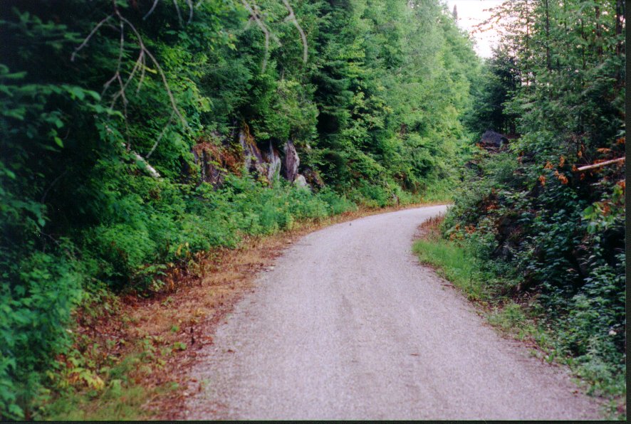
I made Piedmont at 13:55. The old train station that I had ridden by in earlier years was now gone, replaced by only a small parking lot and a few picnic tables. The trail's gentle climb had begun and there had already been a few ups and downs. Past Piedmont I began to see my the first mountains, with rocky cliffs, to the right. At that point the trail falls into a deep canyon running alongside, and just above, the tranquil Riviere du Nord, which is just to the left.
| The First Hills |
|---|

|
| The First Hills on Earlier Rides | |
|---|---|
| 1993 | 1995 |

| 
|
| Piedmont | The Peaceful Rivičre du Nord |
|---|---|

| 
|
Piedmont is the true entrance to the Laurentians, the point where the valley of the North River truly begins to close in. See Supplementary Notes on Piedmont for more information, including an overview of the history of Les Pays d'En Haut and of the nearby centres of Morin Heights and St. Sauveur.
| The Train Station at Mont Rolland | |
|---|---|
| 1998 | 1993 |

| 
|
| Open Countryside around Mont Rolland |
|---|

|
I rode past the spot where I had camped in ‘93, over the old railway bridge, and past the waterfall park. Once past all these landmarks, the trail began its climb in earnest, for the stretch between Mont Rolland and Ste. Marguerite Station remains one of the steepest of the whole trail.
| The Old Trestle | |
|---|---|
| 1998 | 1993 |

| 
|
| Crossing the River |
|---|

|
| The Trail Climbs the Hill | |
|---|---|

| 
|
I made Ste. Marguerite Staton, at 32km, by 15:20, after a long, slow climb in low gear. By going slow all the way, the climb was sustainable. The sun had been beating down all the way up and I should have put on some lotion. Now a thunder cloud was rolling over. I stopped at the small casse-crout that the station depanneur had sprouted since my last visit and had a hot dog.
| Ste. Marguerite Station | |
|---|---|
| 1998 | 1993 |

| 
|
| Mountaintops through the Trees |
|---|

|
Riding on, I made the summit by 15:50. I rode through the rock cutaway, which had become a familiar landmark to me, and stopped briefly to look down on Wexler Falls. The sky above me was was still dark from the thunder cloud, but no rain had arrived yet.
| The Bridge south of Ste. Agathe | Map |
|---|---|

| 
|
| Leaving La Rivičre du Nord | |
|---|---|

| |
I went directly to the “Gare” at Ste. Agathe, which too had been much improved since my earlier passing. It was now a tourist information centre where I could inquire about a campground. I had tried before I left to make a reservation at the campground in Ste. Agathe, but they only took reservations for stays of more than a day, a dastardly policy! So I was a bit anxious when the girl at the info called the campground to see “s’il y a de la place”. Gladly, they said “no problem”.
| Ste. Agathe Train Station | |
|---|---|
| 1998 | 1995 |

| 
|
The campground was 3km away. I had to ride clean across town, including a climb up and over a pretty steep hill, and along the shores of Lac des sables. It had begun to rain as I had come to the “gare”, and now was raining pretty steadily.
| Ste. Agathe: Bike Across Town | |
|---|---|
| Bike Route | Source |

| |

| |
| Full Map | |

| |
When I finally got to the campground, there were not too many sites left. My site was pretty expensive for what I got, a small, narrow patch of green nestled between two trailers. I had a new tent and had to figure out how to it up in the rain. It was a difficult trick because the centre of the roof remained open to the elements until the overleaf was put in place.
| Ste. Agathe Campground | |
|---|---|

| 
|
| Camping at Ste. Agathe |
|---|

|
I was back at the campground by 20:30, but still did not feel ready to retire so I took a stroll around the campground as dusk was descending. I did not climb into bed until 21:30.
| Ste. Agathe: Lac des Sables |
|---|

|