| L'Annonciation to Nomininque |
|---|

|
Roger Kenner
Montreal, Qc,
Canada 2002
| L'Annonciation to Nomininque |
|---|
|
|
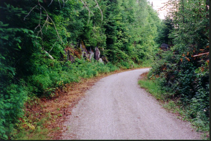
At 09:00 I made a stop in the forest. It was sunny and the sky was blue with little wind and no clouds. All was very quiet except for the distant sounds of Hwy 117. I had crossed to the other side of the highway and was now headed in a southerly direction, according to the sun, which was now 90 degrees to my left. I was at km 136 and the trail was straight, with a little downhill tilt.
| Along La Rivičre Rouge | Lac Nomininque |
|---|---|

| 
|
| Lac Nominique |
|---|

|
The old rail line actually passed quite a distance from the town, which I saw down the road to the right. There was a small kiosk by the highway, where the old station must have been, and the whole area was abuzz with people parking their cars, organizing their bikes, and preparing for a short ride.
Just before reaching the station, I had passed a most interesting section where there were lakes on both sides of me: Lac Nominingue and Petit Nomininque. Each had beaches already beginning to fill up with people on that sunny morning.
I stopped at Nominigue Station for five minutes or so, backtracking to get a proper photo.
| Nomininque Station | |
|---|---|

| |
| Trail Climbs after Nomininque |
|---|

|
All was dead quiet when I would stop. While rolling, the only sound was the friction of my bike tires on the gravel. In the heat of the day, not even the birds made any sound. I came upon a snake, sunning itself on the trail. It was black with a yellow stripe on both sides and was about two feet long.
At 11:00 I at km 154, where there was an iron bridge crossing over what, at the time seemed like just another bubbling mountain brook. I suspect, in looking at the map in retrospect, this was the Rivičre Saguay, draining Lac Saguay into Lac Petit Nomininque. I was probably riding up the river valley, although I had no visual sign of it at the time.
| L'Annonciation to Lac Saguay | |
|---|---|

| 
|
| [See Full Map] | |
From 11:20 to 11:25 I stopped at km 156 and talked with the patrouilleurs.
I stopped at the "Pointe d'Observation sur Marécage" plaque to look out over the marshland and read the explanations
| A Mountain Lake | Beaver Dam |
|---|---|

| 
|
At Noon I was just past the km 160 marker and entering a long climb, with deep wood on both sides of the trail. It was like being on a mountain road: a steep cliff to the left and a sharp drop-off to the right. I stopped to look at a beaver dam, and then at a curious hunting blind.
| Hunting Blind | Around though the Hills: Serious Climbing |
|---|---|

|
|
I reached Lac Saguay, 162km, at 12:15. There was little on the trail except for a small park with a couple of picnic benches. At this point, though, the trail was only a block away from the highway, so I decided to leave the trail and cut over to find a restaurant at the road. Lac Saguay was pretty small and there were not a lot of choices. In fact, there was only one. I had the longest wait for a hamburger at this tiny roadside casse-croute!
The atmosphere was not that great, so I ordered my hamburger to go and when I got it I rode back over to the trail to eat it in the tranquility of the little park. I was on my way again at 13:00.
| Lac Saguay to Mont Laurier |
|---|

|
| [See Full Map] |
| Marshland near the Summit | |
|---|---|

| 
|
| The Trail leads on through the Wilderness | |
|---|---|
| Looking Forward | Looking Back |

| 
|
At 13:45 I am at km 170, at a point where the information placard informed me that a train had derailled in 1947. I rode by what had once been the town of Guénette, now totally deserted, where the trail made an almost 180 degree turn.
The real descent from the heights started at about km 172. At 14:10 I was at km 174.
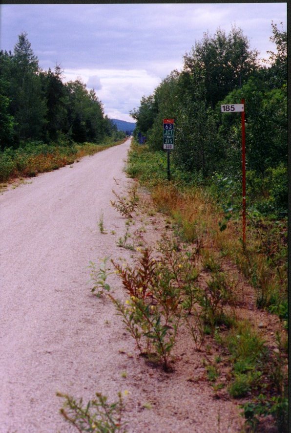
I came upon these intriguing signs which showed that in Winter the trail was very much alive as a snowmobile highway.
| Snowmobile Roads: Jct with '315' at Kiamika | |
|---|---|
| 
|
| Lac des Ecorces (From my eventual campsite) |
|---|

|
| Camping |
|---|

|
| Camping Yvon |
|---|

|

|
By 17:15 I was all set up, had showered, and was ready for my usual evening "rideabout". I asked Yvon if there were any restaurants nearby, but he said there were not. He offered to let me eat with his family for a small price, to which I agreed. I spend the 45 minutes walking down and exploring the small beach facility.
At 18:00, Yvon, his wife, his wife’s sister and mother from Germany, and his many kids all sit around the big picnic table outside. It was like the sort of big, country family dinner I could have expected been back in Antigo with my grandmother. We all have a great dinner, with lots of good conversation. I did my best to talk in German with the mother and the sister.
| Camping at Lac des Ecorces | |
|---|---|

| 
|
Yvon started a campfire around 19:30, and then offered me a beer, gratis. Someone brought out a guitar and there was singing. Many of the other “guests” at the campsite joined in as we toasted marshmallows.
It was 21:30 and already pretty dark when the mother invited us all into the family house for some “dancing”. We all piled into the living room. I was offered another beer. Yvon started things off dancing with his wife. Some of the girls started to dance among themselves. At first I hung by the wall and watched, but finally I danced one or two dances with the sister from Germany.
By 23:00, it is getting late. I take my leave, although the party was still going on. I found my way down the torch-lit trail to my own little cliffside loft, where I climbed into my tent and went right to sleep.
![[See Full Map]](98_Keeps/map_3_03.jpg)