
Roger Kenner
Montreal, Qc,
Canada 2003
It was a sunny, but cool late-season Saturday morning, following a a cloudy and rainy evening before, when I set out for a long ride around the west end of the Island. My goal was to ride out to Ste. Anne de Bellevue along the Lakeshore and then to return along Boulevard Gouin. The commentary is updated from The Original Notes (1999) and integrated with the pictures, where appropriate.
10:40 I headed out after replacing the "designer" front tire I had bought the Summer before, and which had given me such trouble, with a more regular one. My bike chain still out of adjustment and "rattled" at the edge of the gears. (I would subsequently learn that the chain had "stretched' and that what I really needed was a new chain.)
I headed down Monkland, Sherbrooke, and the St. Jackques hill to Ville St. Pierre.
| Ville St. Pierre: Town Hall for Vanishing Town |
|---|
|
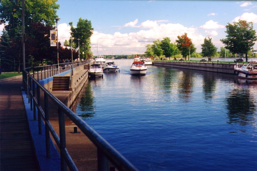
10:50 I took a little rideabout looking for City Hall. I wanted to capture it on film before it dissappeared, for Ville St. Pierre had just amalgamated with Lachine. (Little did I know the whole island was soon to amalgamate!). I finally find the rather unimpressive building, but took a photo anyway. My whole rideabout only lasted about 10 minutes.
| Lachine: Westward Along Tracks |
|---|
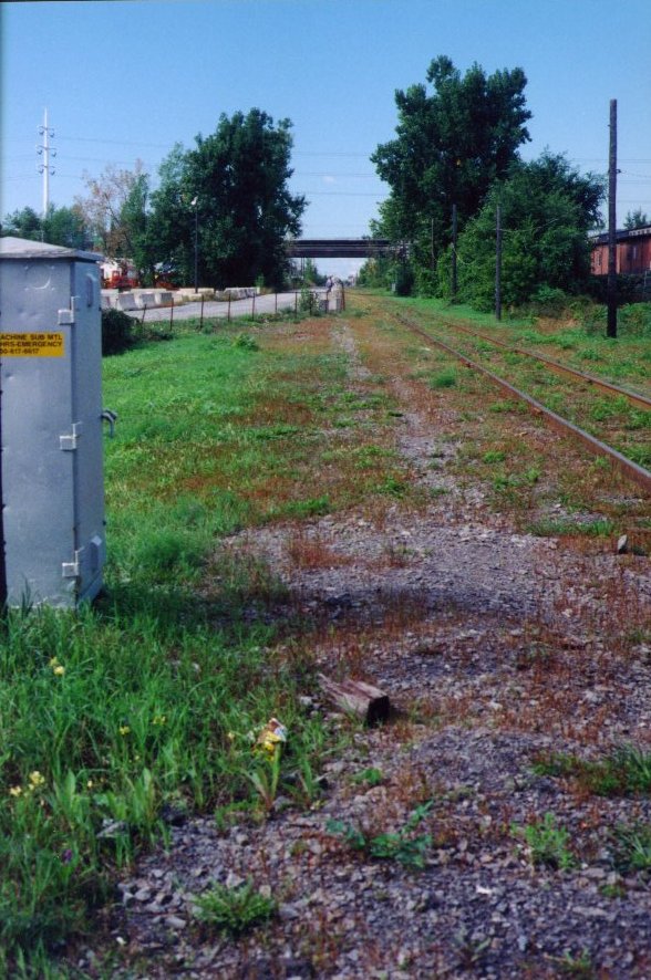 |
I headed west along St. Jacques to the highway and continued under underpass to intersection of end of Notre Dame with St. Jacques and St. Joseph. From that point, I took the old abandoned bus road along the railroad tracks and through the factories, to the end of Victoria.
| Lachine: Coming out at the end of Victoria |
|---|
 |
11:07 I came out at the end of Victoria in Lachine, at 1st Avenue. I followed the Victoria Route until I came out at the DQ by the Lachine Wharf. First I rode along Victoria, next to the tracks. At 6th Avenue, the tracks ended and a bicyle path started in their place. I followed this until it curved to the left along the old railroad right-of-way heading to the Lachine Wharf.
| Lachine: End of Track at Victoria & 6th Ave. |
|---|
 |
| Lachine: Bike Path Along Victoria |
|---|
 |
| Lachine: Cutting Through to Lachine Wharf |
|---|
 |
| Lachine: Coming out by the Dairy Queen |
|---|
 |
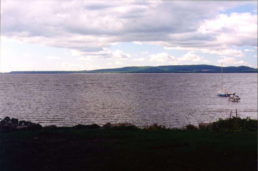
| Lachine: Lake St. Louis & Dorval Island from Stoney Point |
|---|
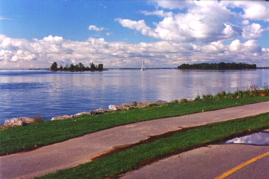 |
11:25 I came out at the DQ. at 'Lighthouse Point, at 'The Lachine Wharf', after having followd the old rail line along which the bike path goes. The lake was clearer that I had ever seen it. With field glasses I could see 3 pilon lighthouses out in the lake. I could see the water tower of Macdonald college. I could see the escarpment wat out past Ile Perrot. And I saw a tall hill rising somewhere out in the West Island.
| Lachine: Along the Waterfront in Stoney Point Park |
|---|
 |
| Lachine: Lake St. Louis near Dorval Line |
|---|
 |
11:40 I reach the Dorval line, where I had to leave the bike path for Lakeshore Blvd.
| Dorval: Ferry Terminal for Dorval Island |
|---|
 |
11:50 I reach Dorval Centre, and take a few moments to check out the ferry dock for Dorval Island. The "Town of Dorval Island", I had learned, was a town of its own. From end of the ferry parking lot, I could sight out the west side of the island right accross to the Beauharnois dam.
Not too far west from there, I passed by the Dorval Yacht Club, and so swung around Henning & Elie's place to say hello. They were out on their back terrace and greeted me pleasantly. I did not stay long.
| Dorval: Point Claire across Valois Bay |
|---|
 |
| Dorval: Along the Shore of Valois Bay |
|---|
 |
12:30 I reached the Pte Claire line along the east side of Valois Bay, after having stopped at a garage sale and having bought lots of heavy books. One book was so large and heavy it would not fit into my sack, and so I had to strap it on the back. Alas, all my bungy cords seemed to have gone missing, so the best I could do was to tape it temporarily.
| Pointe Claire: The Pointe from St. John's Road |
|---|
 |
12:50 I reached Pte Claire village, having rounded Valois bay.
12:55 I reached the Beaconsfield line and stopped nearby for another garage sale. There was nothing interesting. I decided to take the Lakeshore Loop.
13:05 I reached St. Charles road and stopped to check out the shopping centre looking for store where I could buy a bungy cord. I did not find one in the big centre, but did found one in the small shopping centre behind, next to the McDonald's. The bungies were not perfect, but they would do. I re-strapped the book and wrapped it in plastic from the depanneur. The Depanneur guy tried to cheat me out of ten cents (priced at $1.69, sold for $1.79). I went to McDonald's for lunch, where I had a hamburger and drink.
13:35 I started on my way west, along Beaconsfied blvd. That part of the ride was not too nice. At Circle, I left Beaconsfield Boulevard to descent to the bike path along Lakeshore.
14:05 I reached the Baie d'Urfé line
| Ste. Anne: The Town Line |
|---|
 |
14:27 I reached the Ste. Anne de Bellevue line. Right at that spot is a still unexplored road, heading to the right, that leads back to a cemetary. Lakeshore road continues, but I seldom take it at this point, preferring the bikepath through the MacDonald's College campus.
| Ste. Anne: Entrance to Cemetary at Town Line |
|---|
 |
| Ste. Anne: Boat Channel & Boardwalk |
|---|
 |
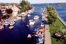
14:30 I reached the Ste. Anne waterfront, where I walked along the Boardwalk. The water level very, very low. The rapids are nearly dry. There was just an expanse of rocks amongs which were some quiet pools and a few rivulets. I had an iced cream cone.
| Ste. Anne: The Locks |
|---|
 |
| Ste. Anne: The Old Church |
|---|
 |
| Senneville: The Town Line |
|---|
 |
15:10 I was on my way, riding north along Senneville Road
15:20 I crossed under the Hwy 40<
In Senneville I would find huge mansions and estates with small, poor homesteads nestled in between. I was surprised to find a still operating apple orchard. There were farms and fields. The woods dark and dense. I rode to the sounds of cows and crickets.
| Senneville: Real Apple Orchard on Montreal Island |
|---|
 |
| Senneville: Fancy House on the Hill |
|---|
 |
| Senneville: Mansion |
|---|
 |
| Senneville: Fancy Grounds & Gardens |
|---|
 |
| Senneville: The Lake of Two Mountains |
|---|
 |
| Senneville: Real Farms on Montreal Island |
|---|
 |
| Senneville: Modest, Old-Style Homes |
|---|
 |
| Senneville: The Quiet, Country Road |
|---|
 |
| Senneville: The Monument |
|---|
 |
| Monument Text |
|---|
 |
This monument represents the furthest extent of my first westward ride along Gouin, back in 1974. I remember being surprised, even then, to still find working farms on Montreal Island!
Following the Lachine massacre in August 1689, the Iroquois continued to terrorize the Montreal area. In October, Governor Denonville sent out a scouting party of 28 under Sieurs Dulhut and d'Ailleboust de Manthet which came upon a party of 22 Iroquois in the lac de Deux Montagnes. In teh mélée that followed this surprise encounter 18 Iroquois were killed, three taken prisoner, while one swam to safety. This victory did much to restore the shaken confidence of the inhabitants.
| Senneville: More Quiet Road |
|---|
 |
| Senneville: Open Meadows & Approaching Civilization |
|---|
 |
| Pierrefonds: Ruisseau ŕ l'Orme |
|---|
 |
16:10 I reached L'Anse ŕ l'orme Road and L'Anse ŕ l'orme, the Pierrefonds line,
16:27 I reached St. Charles Road (The opposite end from a few hours earlier.) The 'citification' had started around Avenue Chateau in Pierrefonds
| Pierrefonds: The Last Farm |
|---|
 |
| Ste. Genevičve: Main Street |
|---|
 |
16:36 I reached the tiny, rustic enclave of Ste. Genevičve, a stark contrast to the modern, commercialism of Pierrefonds. I saw the new French Cegep under construction.
| Ste. Genevičve: Collčge Gerard Godin | |
|---|---|
 |
 |
| Ste. Genevičve: Collčge Gerard Godin-Construction |
|---|
 |
16:50 At the access road for the Ile Bizard Bridge, I crossed back into Pierrefonds (For Pierrefonds totally surrounds Ste. Genevičve.)
17:00 I came to the north end of St. John's Road
17:10 I came to the north end of Sources Road and realized it was decision time. I knew, for searching on an earlier visit, that once I got east of Sources, there would be no further route south until I came to Cartierville. I was getting tired and deciced that I wanted a shortcut. I stopped to by a map, which I studied. I called Sheryl to tell her my back roads route.
17:17 I left Sources & Pierrefond Boulevards with map in hand. I headed south on Sources towards Hymus. (I had been this way before, many years earlier.)
17:40 I reached Hymus and Sources. From there, I followed Hymus a ways, to take St. Francois and Marie Curie down by the airport. It was pretty scary, being on a totally deserted road. While there was an un-looked for stretch of woodlands and meadows, I could also see by the encroaching industrial development that it was not to last long. Nevertheless, I came upon a beaver dam built in the ditch.
| Ville St. Laurent: Beaver dam along St. François Rd |
|---|
 |
| Airport: Watching the Planes come in Along St. Francois Rd. |
|---|
 |
18:06 I crossed under the Hwy 13 along St. François Boulevard. It was a perfect spot to watch the oncoming planes descending in the late evening light.
I followed St. Francois to Cote Vertu and Cote Vertu to Alexis Nihon, which brought me down to the Hwy 40 by the Kraft Plant, where I crossed.
| Airport: Watching the Planes come in Along St. Francois Rd. |
|---|
 |
| Airport: Watching the Planes come in Along St. Francois Rd. |
|---|
 |
| Sunset over Mountain from Blue Bonnets |
|---|
 |
18:34 I crossed into Town of Mount Royal at the Kraft Plant and continued down to Blue Bonnets, which I reached just in time to see a brilliant sunset.
19:05 I reached home. It was about 9 hours after having set out.
| Sunset over Mountain from Blue Bonnets |
|---|
 |