Roger Kenner
Montreal, Qc,
Canada 2003
Foreword
This account is based on the original description of the ride around Two Mountains and Oka, but has been edited to deal primarily with the West Island return portion of the ride. (The Two Mountains/Oka/Hudson section will receive further treatment elsewhere). Where additional comments seemed appropriate, I have added these within "[ ]".
The ride was significant in that:
- It was the first time I had done the Two Mountains/Oka/Hudson loop, although I had earlier ridden along both coasts. I had only heard about this possibilty when speaking with Claudia & Gilbert somewhat earlier
- It was my first time ever crossing via the Oka/Hudson ferry
- I had not been along the north side of the West Island for some time
- I got caught in a major and somewhat frightening thunderstorm, and was close to danger as live electrical wires were tossed to the ground.
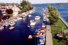
Tour of Lake of Two Mountains:
Roger Kenner, July 1997
Departure: 7:25
It was a foggy, muggy morning. The low fog hung overhead, making the day look overcast. It was a tough call: Was it going to rain or not? The weather channel announced "fog, clearing to partly cloudy, with chance of afternoon thunder showers". As I rode along, the sun and patches of blue would poke their nose through the grey from time to time, at other times the sky would darken and a few drops would fall. It would be cool all morning, and the sky would not clear until 12:30.
Across the Island to the Back River
[7:25 - 8:15: 45 Minutes]
Montreal: I rode over to Grand Boulevard and headed north along the busy boulevard.
Hampstead: As it crossed Cote St. Luc Road, Grand Boulevard became Glenmore, a quiet residential street. I followed my formerly well-worn path across Hampstead: Right onto Haverstock, for one block; then left onto Albion, for one block;, then right onto Merton, a quiet residential boulevard. Merton eventually became Landsdowne. I turned left onto Dufferin, which took me across Fleet Road. Then I turned left onto Ferncroft, heading east.
Montreal: Ferncroft became Plamondon as I crossed back into Montreal. I came to Clanranald, onto which I turned left. It brought me past Decarie Square and came to a stop at the railroad tracks.
[7:25-7:40: 15 minutes riding]
Blue Bonnets: I portaged my bike across the railroad tracks (Which is against regulations) and then continued straight (north), across the Blue Bonnets parking lot to the far side. There I followed the access road, a fairly busy, industrial street, as it lead to the left, around behind the stands. I turned right onto the 'connecting' street that has been pushed through the line of factories to the Town of Mount Royal street beyond.
[7:40-7:45: 5 minutes, 20 minutes riding so far]
Mount Royal: Once into TMR, the street became Devonshire, a busy, wide industrial street. I followed Devonshire along the factory row to its end at the Kraft Food Plant by the Metropolitain Expressway (Hwy 40). Right where Devonshire ends is a pedestrian walkway across the railroad tracks and under the highway, which I took.
[7:45-7:50: 5 minutes, 25 minutes riding so far]
Ville St. Laurent: I followed the quiet residential streets of Ville St. Laurent, parallelling the main boulevard, Marcel Laurin, along the west side. First I turned right onto Authier, then right onto Scott, then left onto Marlatt, then right onto De l'Eglise, then finally left onto St. Aubin. I followed St. Aubin to Cote Vertu (7:58)
I turned right on Cote Vertu, a very busy main boulevard, to go one block east to Marcel Laurin, which was also very busy. I turned left onto Marcel Laurin (Actually, I angled to the far side of Cote Vertu and nipped into the shopping centre on the northwest corner of the intersection. Then I followed the sidewalk (Against regulations) up along the west side of Marcel Laurin, in the face of oncoming traffic.)
After two blocks, I came to Thimens, yet another busy boulevard, but not quite as busy. I turned right onto Thimens and followed it one block east to Grenet, where I turned left. I would follow Grenet to its end. Grenet parallels Marcel Laurin just to the east, but is less busy. It goes along behind some Canadair buildings and behind the new shopping centre. On the right (east) side it is all residential.
[7:50-8:08 18 minutes, 38 minutes riding so far]
Montreal: Grenet crossed Henri Bourassa (8:08) and then continued, underneath the Cartierville train station and into Cartierville. I continued Continue straight on Grenet. I crossed De Salaberry (8:12) and finally came to Grenet's end at Boulevard Gouin (8:15). [The first time I came up this way, I remember nosing my way around, and following De Salaberry east, to see where it might take me. I ended up turning around after a few blocks and returning to Grenet.] I turned left onto Gouin, a very busy boulevard, and continued for one block. I turned right onto Lachappelle, a quiet residential street paralleling the main road, and followed it to the end, at the bridge approach. At the end of the street, a bike path led on, curving underneath the bridge. This was not the way I wanted to go that day. [Indeed, I have yet to go that way!] Instead, I went up onto the bridge sidewalk and rode across the bridge.
[8:08-8:15 7 minutes, 45 minutes riding so far]
I continued along my way....
The full account can be read in the original notes.
Ile Perrot: Coming off the Highway 20 bridge on the Ile Perrot side (13:55), cyclists are channelled onto the access road by the shopping centre. I had to follow the road around to the intersection, where I then turned left and went back to the highway. At the highway underpass, I had to turn right on the access ramp and ride back up to the main road. It seemed like a freeway, but there was no "Bicycles Prohibited" sign. Still, riding along the shoulder, with cars and big trucks zooming by at 100kph was quite worrisome. Thankfully, as soon as I left the ramp and got onto the highway proper, the extremely wide shoulders were available again.
There was at this point a very strong tailwind and I nearly flew across Ile Perrot, reaching the second bridge, the Pont Galipeau, ten minutes later at 14:05. I went up on the sidewalk as I crossed the bridge, coming down into Ste. Anne de Bellevue at 14:10. [13:50-14:10 20 minutes, 4 hrs and 40 minutes riding so far, 1 hr & 15 minutes stops so far]
Along the North Shore: Boulevard Gouin: Ste. Anne to Cartierville
14:10-16:20: Two hours & 10 minutes, with a 15 minute rain stop
Ste. Anne de Bellevue: Coming down off the bridge on the sidewalk, I made a 180 degree turn as soon as I could to go back down the hill along the bridge embankment. I followed the road down to its ends at the town's main road, by the waterfront. Once I got to the base of the embankment, I found the access to the official bike across the bridge, which had eluded me on my previous visit [when I had ridden out to Pointe du Moulin on Ile Perrot.] It was at the back of the parking lot under the bridge, by the locks.
Rather than head back via the Lakeshore, which I had done several times, I decided to go back via the North Shore, which I had not done for quite a number of years. I also decided not to stay and visit in Ste. Anne, as I had been there many a time before and the hour was getting late.
As I was coming down off the bridge, I had noticed how big and black the clouds out over the lake had become. I hoped it would blow over, or head in a different direction.
Senneville: I turned right at the bottom of the bridge approach and followed the main road under the bridges and past the locks. I turned right onto Ste. Anne, then left onto Pacifica, then then right onto Grier, All were quiet, residential streets. Finally, I came to the main road out of town, onto which I turned left. As soon as one I turned onto the main road, which still had the air of a quiet, country road, I saw the Senneville sign.
The road through Senneville was beautiful and wooded, with tall, towering trees on either side. I passed by fantastic properties situated along the along the lakeshore. Soon I was passing underneath the same Hwy 40 which I had crossed earlier while approaching Dorion from Hudson (14:20).
The RainstormI was tempted to stop under the freeway bridge, as the sky was getting really dark. I was not sure how far I would get. As I continued, too far past the bridge to turn back, I came upon a section with very tall trees. Suddenly a fantastic gust of wind began violently whipping the tree tops. They were bent so far over as to nearly touch the trees on the other side. All the while, down at ground level, I hardly felt anything. Still, I rode on quite fast, my adrenaline pumping. I was scared the wind would blow a piece off of one of those trees right over my head.
As I rode, I suddenly heard a loud crack behind me, maybe half the length of a city block back. I looked back to see several bright stars where a tree was leaning onto the power lines. Now I was really scared. I did not stick around, but leaned into my peddles. I was afraid the tree would pull the lines down on the road where I was riding. An awful sizzling, crackling sound came to my ears. A few moments later, I saw the reflection of a brilliant flash behind me. Then there was a loud bang. I looked back to see the transformer explode is a ball of white light. Then all was dead. I felt relieved that the power was now out.
There is one sharp hill along that route and I was huffing and puffing so that I almost went over the top in my normal cruising gear. I had to stop at the top to get my breath.
The wind had lessened a bit. While still very strong, the violent gusts of a few moments earlier subsided. It became obvious, though, that heavy rain was on the way. All was very dark, almost like night. I rode on desperately, hoping to reach a more settled area before the rain started. I did not want to be caught out in the open during a thunderstorm.
I looked out on the lake and saw the wall of rain approaching, cutting off from view everything behind it. I saw a few foolhardy sailboats and windsurfers scrambling for safety, but I doubted they would reach shore in time. I rode on as fast as I could. (It was really too bad that I had to race through that section, as it would normally be the nicest part of the ride.)
Suddenly the rain hit in full force. I had no choice but to turn into an open driveway and take shelter under someone's front door awning. I was dry, but alas my bike had to remain out in the rain. I waited out the storm from 14:35-14:50. The water was coming down so strong I could hardly see across the lawn. Surprisingly, there was no thunder or lightning. I imagine the storm cell was still just forming.
At 14:50, the rain ended abruptly and the sun came out almost instantly. The dark storm quickly became an innocent white cloud, looming off to the right. Where there had been a strong wind all day, suddenly all was very still.
I rode on through the only remaining farmland on the island, reaching the Pierrefonds line at 14:55.
[14:10-14:55 30 minutes, 5hrs and 10 minutes riding so far, 1 hr & 30 minutes stops so far]
Pierrefonds: Through the first section of Pierrefonds, Boulevard Gouin remained the quiet country road it had been through Senneville. This farmland atmosphere continued as far as St. Charles Boulevard. When I passed l'Anse ŕ l'Orme, I got my last view of the Lake of Two Mountains before the road turned due east to cut across Cap St. Jacques (15.05). At the far side of the cape, Boulevard Gouin ran right along the shore of the Back River, and I had great views of the undevelopped side of Ile Bizard. I came to St. Charles road at 15:20.
At 15:25 I passed the Ile Bizard Bridge and the quiet road was beginning to become a narrow, congested one. There were no more fields or farmhouses, just suburbs and riverfront properties. I declined to go inland to Beaconsfield Boulevard, where they have a bikepath which is just some lines on the pavement of a wide boulevard, with no trees. I preferred Boulevard Gouin, with its occasional glimpses of the water.
Ste. Genevičve: While riding along the river on Boulevard Gouin, I passed through the small hamlet of Ste. Genevieve. I was not even conscious of any difference until I came to the church at the centre of town. Almost immediately afterward, I cam to another Pierrefonds city limits sign.
Pierrefonds, once again: I reached the end of St. John's Road at 15:30 and at 15:45 I passed the end of Sources Road. East of Sources, Beaconsfield Boulevard swings over to join Boulevard Gouin, which turns it into a wide, city boulevard.
Roxboro: I passed the town of Roxboro. I came to the Roxboro train station at 15:50 and the A Ma Baie station at 15:55.
Pierrefonds, once again: I then re-entered Pierrefonds for the third time. Along that stretch the commuter train line ran now parallel and just south (to the right) of the road. I saw several of the sleek, new electric trains.
Montreal: I crossed under Highway 13 at 16:05. This was the point where I re-entered Montreal. For a ways, Bois de Saraguay, Boulevard Gouin returned to its original country road size. It did not return to the original country road traffic level, however. As I negotiated the broken pavement along the edge of the road, I had to share my tiny space with an endless stream of cars and buses. I tried several sidestreets, attempting to find a bikepath that would cut across the tracks and head south. Alas, I might as well have just stayed on Gouin. There was no opening to the south.
I reached Laurentian Boulevard in Cartierville at 16:20, closing the circle I had made that morning.
[14:55-16:20 85 minutes, 6 hrs and 35 minutes riding so far, 1 hr & 30 minutes stops so far]
Cartierville to NDG
16:20 to 17:35: 1 hour riding, with 15 minutes stop
I turned right onto Laurentian Boulevard, a very busy commercial roadway, and rode through Cartierville. At 16:25 I was passing under the railway bridge and crossing Henri Bourassa.
Ville St. Laurent: In Ville St. Laurent, Laurentian Boulevard became Marcel Laurin, but otherwise remained as busy. Along by Canadair, they were working on the road, narrowing all the traffic to two lanes and finally to only one. I rode on the sidewalk.
At 16:35 I crossed Thimens and, two blocks later, Cote Vertu. I turned right on Cote Vertu for one block, and then left on St. Aubin. The first couple of blocks of St. Aubin are one way, to discourage motorists. I went up the street anyway (Against Regulations), so as not to get lost. I followed my route of the morning back to and under the Metropolitain (16:45)
Mount Royal:I rode back along Devonshire. Just before reaching Blue Bonnes, I turned left to head out to Decarie and the Orange Julep. I got there at 16:55 and stayed until 17:10.
Montreal: I rode along Decarie only as far as Blue Bonnets. I turned back into the parking lot and followed the road to the left to come to the train tracks. I portaged my bike over the tracks (Against Regulations). and came out by Decarie Square.
I followed my normal route home from there, reaching home at 17:35.
[16:20 17:35 60 minutes, 7 hrs and 35 minutes riding so far, 1 hr & 45 minutes stops]