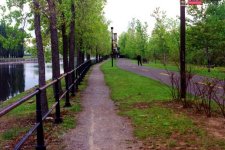
| West from Railway Bridge through Cote St. Paul New footbridge visibile in distance | Cote St. Paul looking East towards Atwater |
|---|---|

| 
|
Roger Kenner
Montreal, Qc,
Canada 2002
[Early Days]
[1999]
[2000]
[2001]
[2002]
[Many items have been suppressed in this Lite Version]
All that I remember from the early days of riding along this section of the Bike Trail was a seemingly unbroken wall of old factories along the opposite shore. The Trail ran along a narrow band of the south bank, until is suddenly opened out into a larger space where it went alongside St. Patrick. At this point a big signs stated that the land was part of the park system of the City of Montreal rather than that of the federal canal.
The footbridge shown was not built until the early 1990s, though it is clear that plans were in the works early on. Rail yards lined the south bank until the late 1980s, when they were replaced by a wood lot. Just west of the St. Remi Tunnel is shown a small building. The Trail curved around this building as it regained the shoreline, in what has always been one of the most dangerous blind curves along the way.
Although there was a trail heading east from the Locks a short way, I never explored in that direction. Typically I would cross the Canal at the Locks. Often I would stop and enjoy the park and picnic tables set up on the centre island. It was here that Alex cracked his head in 1993.
From here, the official trail descended the embankment to leave those heading west to ride half a block along Cote St. Paul Road. It was also here that I would catch and leave the trail, riding the other way along Cote St. Paul, to eventually climb the hill on St. Jacques towards home.
Once or twice I continued along the south bank, but the cross-over at the Cote St. Paul Bridge was not typically friendly. In later years, the old rail path (now gravel) was left open along the north bank, and people began to unnoficially (for signs said it was private property) continue along that way.
At the entrance to the long stretch along the north bank, west of the Bridge, was a major 'halte', consisting of two railway cabooses. At times there have been casse-croutes and bike repair stations opened there.
The map below, from a much later period, shows things pretty much unchanged. Of note is that the footbridge west of the Locks still had not been built. The Trail extends, however, as far as the future location of the park.
West of the CN Bridge, the Trail runs along the south bank. In these later photos, the hedge which use to line the right-hand side of the trail is gone. The large, vacant lot shown a bit further on was once a railward, and then a wood lot. Today it has, once more, been transformed. .
| West from Railway Bridge through Cote St. Paul New footbridge visibile in distance | Cote St. Paul looking East towards Atwater |
|---|---|
|
|
|
| Cote St. Paul looking West towards Locks & Turcotte |
|---|

|
| Crane Industries Building in Cote St. Paul |
|---|

|
It was here at Crane Industries that Bernie and I picked up the 8 boards from Reggie, who was working at cleaning out the building, and began our long trek westward towards Walkley Street in NDG. This expanse of grass was 'city property', according to the signs.
| Cote St. Paul looking West towards Locks & Turcotte |
|---|

|
I never gave the St. Remi Tunnel much thought during all the years I cycled right over it. (I have cycled through it once, back in 1974, on my way to the evening with Cynthia, my fling at the time.) I took the 1999 picture by fluke. It was later that same year that passage over the footbridge became possible, and I took the latter picture, following my new route.
| Over the St. Remi Tunnel | St. Remi Tunnel |
|---|---|

| 
|
| Locks at Cote St. Paul Construction already underway |
|---|

|
| Construction at Cote St. Paul Locks |
|---|

|
It was us this ramp that I accessed the Canal Trail from home, for rides east, during all the years that I lived in the west end of town.
| Old Access Ramp to Cote St. Paul Locks Closed for Construction |
|---|

|
I seldom came this way, crossing most of the time at the Locks and proceeding along the north bank.
| Trail approaching Turcotte on South Bank |
|---|

|
| East along Canal from Cote St. Paul Bridge |
|---|

|
I passed by the Cote St. Paul Locks again the following year, to see how work had progressed. There was new concrete everywhere, but the complex was still not open. One could not cross there.
| Cote St. Paul Locks: New Spillway |
|---|

|
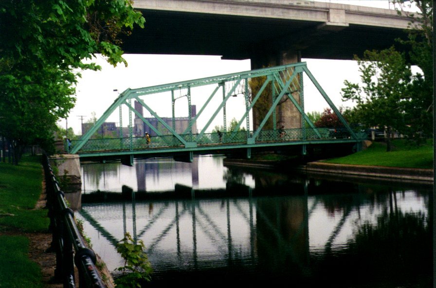
I had heard that the Cote St. Paul bridge was to be replaced, so I felt I should get a picture of it as it was. I've subequently learned that this is only half of the original swing bridge. The south embankment is really the original central island onto which the bridge swung. The south channel has been filled in.
| The Bridge at Cote St. Paul |
|---|
|
During the Summer of 2001, they had an exhibition of 'floating art works' along the Canal reach below the Cote St. Paul Locks. This photo is just west of the CN Bridge and in the background is the 'Merchant's Manufacturing Complex.
| Cote St. Paul: River-Art East of Cote St. Paul Locks |
|---|

|
In early Spring of 2002, I paid a visit to the new Cote St. Paul Locks, to see how they had turned out. They were to open in just a month or so.
| Long View, from Cote St. Paul Locks |
|---|

|
| Looking Upstream |
|---|

|
| The Lock Basin |
|---|

|
| Looking Downstream |
|---|

|
It was only when I started accessing the Canal via the St. Remi Tunnel entrance that I began to notice the historic 'Canada Malting' factory. Most notable were the grain elevators clad with ceramic tiles. I decided I should take some pictures of this landmark before it vanished or was converted into condos.
| Interesting Architecture | Glazed Tiles on Silos |
|---|---|

| 
|

| 
|
I went back to the old bridge and was pleased to find that it was still there, and would not be taken down. They were in the process of raising it, so boats could pass underneath.
| View from Upstream |
|---|

|
| Raising the Bridge | |
|---|---|

| 
|
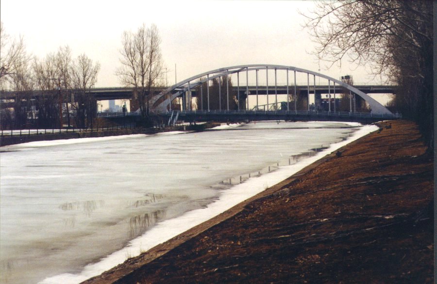
The new bridge was nearly completed. Cyclist were permitted to path through during the entire construction phase.
| Opening Soon | |
|---|---|

| 
|
| New Monk Street Bridge |
|---|
 |