(Taken from 'MapArt Niagara Map')
to Fort Erie


Roger Kenner
Montreal, Qc,
Canada 2001
| Niagara-on-the-Lake to Fort Erie |
|---|
|
|
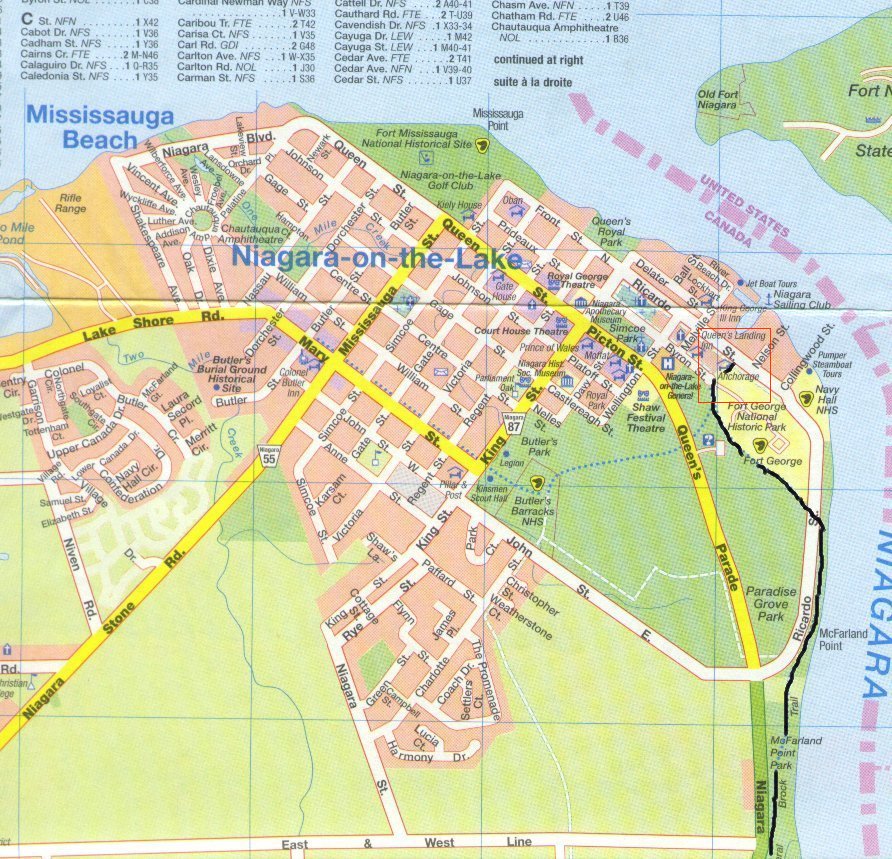
The "Waterfront Trail", which I had been following for five days came to its official end at the harbour of Niagara-on-the-Lake, right next to the motel where I was staying. From the same point began the trail I would not be on, called "The General Brock Trail"after the hero of 1812.
Our motel price included a continental breakfast, to be delivered to the room. Normally the breakfast would be for 08:30, but I had asked that it be delivered at 07:30 so that I could get my usual early start. I was up at 06:30 and all ready to go by 07:30, but the breakfast did not come. I finally phoned the office and reminded them, at which point it came right away. They brought muffins and yoghurt, to add to the coffee we were able to make right in the room with the little coffee machine that was part of the room's decor.
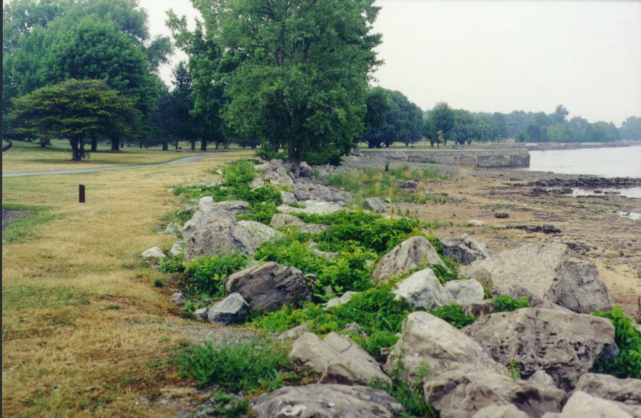
General Brock Trail was a beautiful, paved path that ran through parkland the along the length of the river, under trees, and mostly to the river side of the road for cars, which was called the Niagara Parkway. As far as Queenston, the trail would be flat, while across the road would be stately houses and wineries interspersed with vast open fields of grape vineyards. There was the river, which was at the foot of a small cliff, then the bike path I was on, then parkland, then the road, and finally the farms.
| Niagara-on-the-Lake: Starting Out |
|---|
|
| Niagara-on-the-lake | |
|---|---|
| Trailhead: Waterfront Trail | Looking back on Harbour |

| 
|
| Niagara-on-the-Lake to Reif Estate | Niagara-on-the-Lake to Queenston |
|---|---|

| 
|
| Niagara Parkway | |
|---|---|
| Trail along the Road | View of the Niagara River from below Queenston |

| 
|
| Queenston to Niagara Glen |
|---|
|
| Queenston: Entrance to town |
|---|

|
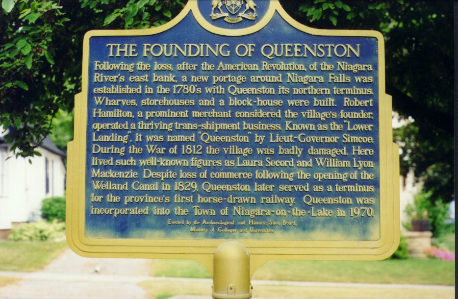
The bike trail ended briefly at Queenston and I found myself on the tiny streets of the hamlet itself. On the way into town, I rode past this big house up on a hill: Willowbank, built by Alexander Hamilton.
| Queenston: Willowbank Estate |
|---|

|
I then rode past Laura Secord's homestead. Laura Secord was a heroine of the War of 1812, when she had travelled across open country to warn her husband of the landing of American troops. I made a ten minute stop at the homestead, which has now become a tourist attraction. The staff were just opening up, and the parking lot, large enough for many tourist buses, was still empty. I looked in the gift shop, but there was nothing interesting, so I rode on.
| Queenson: At the Laura Secord Residence |
|---|

|
| Information Plaques | |
|---|---|
| The Founding of Queenston | Laura Secord |
| 
|
|
[Historic Plaque]
|
[Historic Plaque]
|
| Information Plaque: Niagara Escarpment |
|---|

|
|
725 kilometers across Ontario from Niagara Falls to Manitoulin Island. Over 430 million years ago, a shallow tropical sea covered most of central North America. Sediments and coral reef on the seabed were compressed into dolomite, a hard type of limestone which was more resistant to erosion then the bedrock of the adjacent lands after the water retreated. The cliffs of the escarpment are the exposed floor of the ancient sea. The escarpments rugged terrain, home to a wide variety of plants and wildlife forms a natural< corridor through both urban and rural areas. In 1990, the United Nations designated the Niagara Escarpment a World Biosphere Reserve. |
| Niagara Escarpment: Climbing Up | |
|---|---|

| 
|
I stopped at the overlook at 10:10 and had a great vista of the tree-lined Niagara River snaking its way across the plain until it lost itself in the vast blue of the lake beyond.
| Niagara Escarpment: View downriver from Lookout |
|---|

|
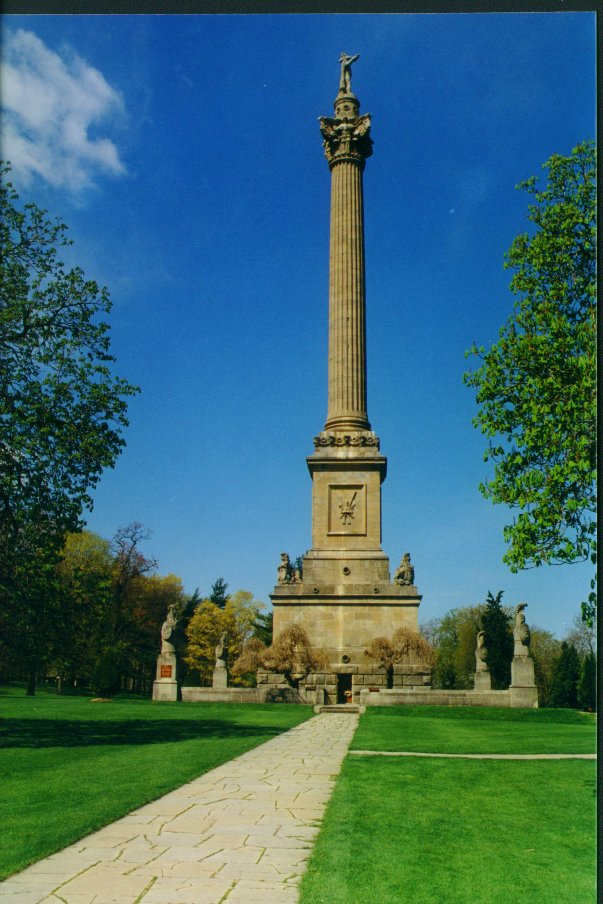
| Brock Monument: Base of Tower |
|---|

|
Queenston Heights and the Brock Monument is the northern terminus of the Niagara People Mover, a wonderful set of buses for ferrying tourists up and down the River, to all the major sights.
| Brock Monument |
|---|
|
| Brock Monument: Side Entrance |
|---|

|
| Brock Monument Park: Laura Secord Monument |
|---|

|
| PowerStation to Falls |
|---|

|
| Niagara Parkway: The Floral Clock |
|---|

|
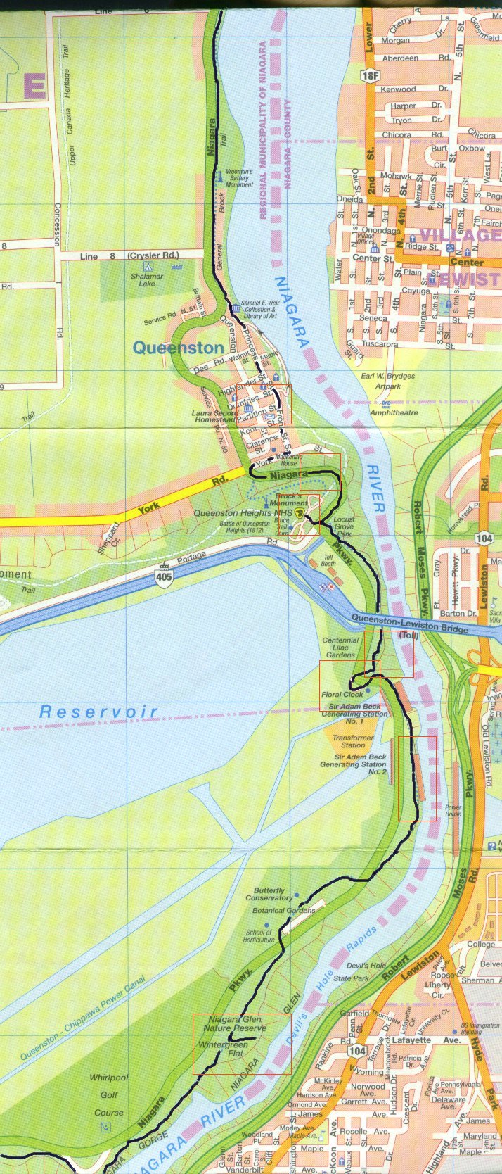
I rejoined the bike trail and immediately passed underneath the freeway bridge linking Queenston and Lewiston, a bridge I had once been across this bridge in 1983.
| Niagara Gorge at International Bridge | |
|---|---|
| Approaching the Span | Beyond the Span |

| 
|
| Niagara Gorge Under International Bridge |
|---|

|
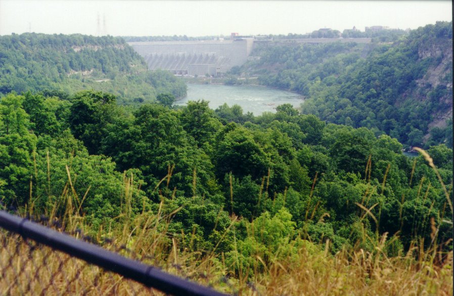
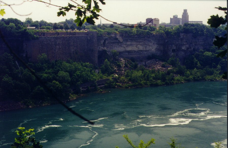
| Niagara Gorge: The Power Stations |
|---|

|
| Niagara Gorge | |
|---|---|
| Trail along Power Station Crest | Turbulent River at the Power Stations |

| 
|
Past the Power Station, the bike trail left the Gorge and crossed over to the landward side of the Niagara Parkway, to go by the Botanical Gardens. It then returned once more to the river side, where I was much happier.
| Niagara Gorge: Looking upriver from Power Station |
|---|

|
I came to Niagara Glen, where there was a huge park. I left the trail there and rode down the twenty foot embankment and out to the lookout point. There I could see upstream as far as the Whirlpool Rapids, and downstream all the way back to the power houses.
| Niagara Glen Park | |
|---|---|
| Looking upriver towards Whirlpool Rapids | Looking downriver towards Power Stations |

| 
|
There were stairs descending from the cliff down to the water's edge. I presume one would find there lots of paths for hikers along the Devil's Hole Rapids. I'd have to save that for another trip, though. I did not have the time and it would have been impossible to negotiate the stairs with my bicycle. I passed 10 minutes altogether at the Glen, from 11:15 to 11:25.
| Niagara Glen Park:Stairs to Lower Trails |
|---|

|
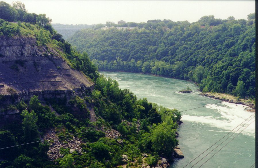
Just a short way down the trail, still along the crest of the Gorge, was Thompson Point, the northern anchorage of the Spanish Aerocar over the Whirlpool Rapids. I stopped for 5 minutes to watch the Aerocar, upon which Sheryl and I had ridden in 1996. Down along the shores of the River, I could see hikers and fisherman along the rocks of the American side.
| Niagara Gorge: Thompson Point overlooking Whirlpool Rapids |
|---|

|
| Thompson Point | |
|---|---|
| Looking upriver from Whirlpool Rapids | Looking downriver past Thompson Point: The Spanish Aerocar |
| 
|
From Thompson Point, the trail leads around the bend of the Whirlpool Rapids and one loses sight of the water for a while. The trail continues along the Parkway, with deep woods to the left. Lots of trails headed off in that direction, so I presume one could hike down to the water, or at least to the crest of the Gorge. At each trail head was a sign indicating that the Niagara Parks Authority absolved themselves of all responsibility for anyone taking the trails.
As I came around to the far side of the cove, climbing the hill towards the parking lot for the main Aerocar anchorage, the separate bike trail vanished. From that point on, to past The Falls, I would be sharing the often quite-narrow sidewalk with pedestrians.
There was a huge crowd at the AeroCar. Lines were already stretching out into the parking lot. Sheryl and I had learned in 1996 the trick to seeing these touristy things: One bought the "3-in-1" pass for the main sites, and an all-day ticket for the People Mover. First thing in the morning, one had to visit the Tunnels under the Falls, as these were the first to develop a line. Then one took the People Mover directly to the AeroCar, beating the crowds this second busiest attraction. The Great Gorge Adventure, the third attraction, is always less crowded, for few know how spectacular it is. (It is actually the most interesting of the three.) Finally, one walked across to the American side to take the Maid of the Mist from there, where it is always much less crowded.
For an account of this visit, see the Notes on Visits to the Niagara Region.I dismounted and made my way on foot past the crowd of pedestrians at the Aerocar. Once past, I was again able to start riding again, although only along the very narrow sidewalk on the Gorge wall side of the Niagara Parkway.
| Niagara Gorge: Turbulent River above Whirlpool Rapids | |
|---|---|

| 
|
What had been open parkland on the far side of the road gave way immediately to a line of motels and B&Bs. As I rounded the corner, just across from the Great Gorge Adventure, there was a huge Buddhist Temple: The 10,000 Buddha Temple.
| Niagara Parkway: 10,000 Buddha Temple | |
|---|---|

| 
|
Not too many people were waiting for the Great Gorge Adventure, which is really one of the nicest sights. An elevator goes down through the rock to water level, where there is a boardwalk right along the fierce whirlpool rapids. I had come this way with Sheryl in 1996.
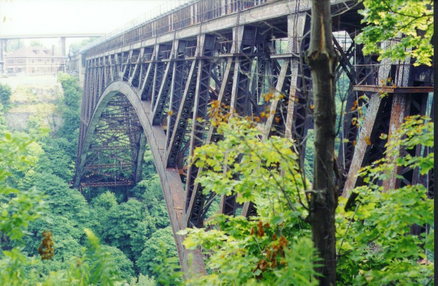
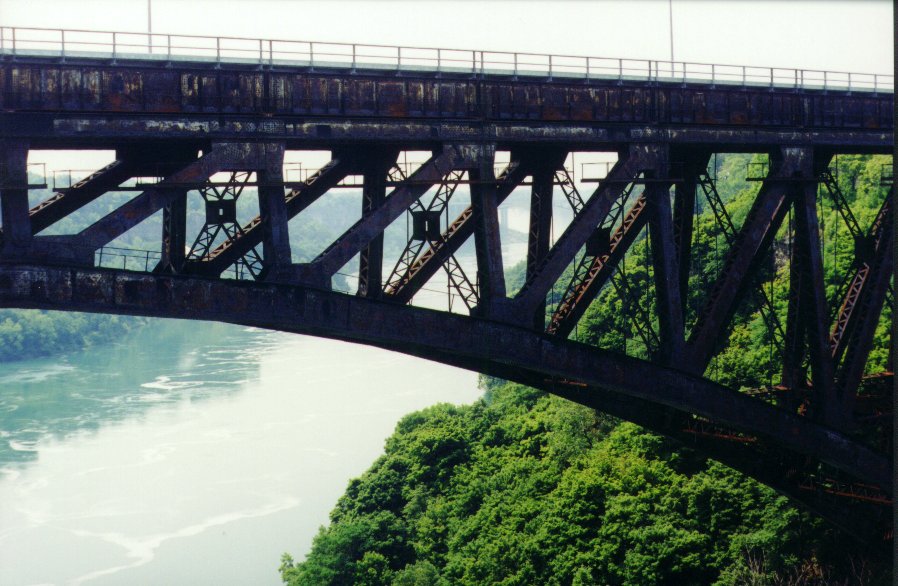
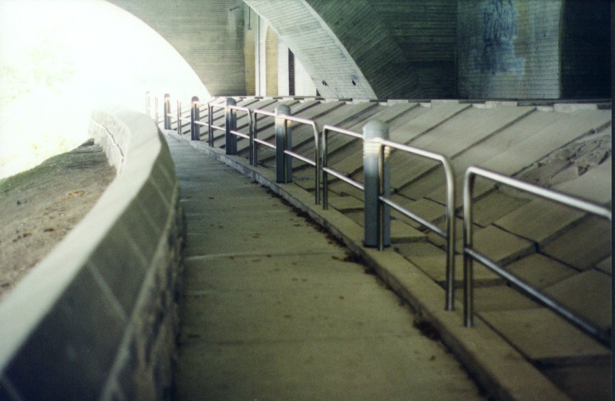
Just past is the Whirlpool Rapids Bridge. The top deck is a railway bridge, with a deck for cars underneath, and pedestrian walkways on both sides of the lower deck. I wanted to walk out on the north side to get a good photo upriver of the rapids, but was unable to do so.. The southern walkway was open and unguarded all the way across for Canadians, with the opposite being true for Americans. I would have had to cross and come back in order to walk on the north side.
| Niagara Bridge: Amtrak Train on Bridge |
|---|

|
I was lucky to catch an Amtrak train crossing the bridge, and watched it stop at U.S. Customs. Just next to the first bridge is another old and rusty railroad bridge.
| Amtrak Train (Closeup) |
|---|

|
| Niagara Whirlpool Bridge | |
|---|---|
| Looking Back along Pedestrian Walkway | Car lanes under Railway Tracks |

| 
|
| Niagara Gorge: Looking Back on Bridge | |
|---|---|

| 
|
| Old Railway Bridge | Looking upriver at Old Railway Bridge |
|---|---|
| 
|
| Niagara Gorge: Looking upriver towards Rainbow Bridge |
|---|

|
| Niagara Gorge: Site of old Collapse |
|---|
|
| Site of old Collapse (Detail) |
|---|

|
| Niagara Gorge: At the Rainbow Bridge |
|---|

|
| Rainbow Bridge to Welland River |
|---|

|
.
| View of American Falls from Beneath Bridge | Rainbow Bridge Trail beneath the Bridge |
|---|---|

| 
|
Past the Rainbow Bridge, I got caught up in the huge tourist structure built around the Maid of the Mist. There were myriad walkways and lookouts, complete with an underground mall. A sign at the entrance had indicated "No Bikes, but I had ignored it. It was only on the far side that I would discoverer that I could not get out, on account of long flights of steps, and so had to backtrack through the thick throngs of people to the beginning.
| The New Niagara | |
|---|---|
| Maid-of-the-Mist Complex | the Casino |

| 
|
All of this was new since my last visit of 1996. Indeed, many new, tall buildings had been build up along Clifton Street, so that one would never recognize it from 1996. There was the huge Casino, for example, and the new Planet Hollywood building. Up over the Falls themselves were new high rise hotels, � la Las Vegas. There was a new incline railway to bring people from the hotels on the ridge right down to the Falls. All of this was brand new.
| Niagara Falls: Roger at the Falls | |
|---|---|

| 
|
I stopped and got some photos of the American Falls, right across the river, and of the Horseshoe Falls, from a distance. I did not end up going right to the edge of the Canadian Falls, for it was far too wet on account of the mist. It was like being in a rainstorm! Besides, as the crowds got ever thicker, it became more difficult for me to manoeuvre my bike, even when walking it.
| Niagara Falls: The American Falls | |
|---|---|

| 
|
| Niagara Falls: The Canadian Falls | The Old Power station (Detail) |
|---|---|

| 
|
| The Maid-of-the-Mist Crowd | Old Victoria Park Complex |
|---|---|

| 
|
| Approaching Table Rock Complex | Maid-of-the-Mist in Spray |
|---|---|

| 
|
| The New Niagara | |
|---|---|
| Fancy, New Hotels | New Funicular Railway |

| 
|
| Past the Falls: Looking back from near Crest |
|---|

|
| Past the Falls: Looking back from near Crest |
|---|

|
| Past the Falls: Looking back from near Crest |
|---|

|
I went by these historic turn-of-the-century powerhouses, first the one across the road and then the one alongside the river. These powerhouses were beautiful, masterpieces of architecture for their day. It was this cheap power which had built up Toronto. The trial kept me right by the water's edge, leading me over several small bridges and crossing the various water intakes for the power plants.
| Past the Falls: The Old Powerstation | |
|---|---|

| |
| Detail Canadian Niagara Power | 
|
I do not recall having come this way, venturing so far above the Falls outside a car, since 1972 when my parents had brought me here. At that time we had had to park well above the Falls and had walked down.
| Past the Falls | |
|---|---|
| Looking back from near Powerstation | Power Station Intake |

| 
|
| Niagara Parkway: Greenhouse near Power Station |
|---|

|
| Past the Falls: 1906 Power Station | Closeup: Electrical Development Company |
|---|---|

| 
|
| The Falls from Above | Spillway at the Power Station |
|---|---|

| 
|
I came to the International Control Dam, a structure which goes out into the River as far as the border, and is used to control the flow of water over the Falls. I then went by the two giant intakes for the big powerhouses and reservoirs downstream. According to the indicators, these are at the head of giant 13-metre wide pipes. One could feel the force of their vibrations, even though they were underground.
| The Falls from Above | International Control Dam |
|---|---|

| 
|
| Past the Falls: Across the Welland River |
|---|

|
.
| Welland River to Chippewa Battlefield |
|---|

|
| Chippawa: The Welland River | Boat traffic on the Welland |
|---|---|

| 
|
At the mouth of the Welland, I was near the town of Chippawa. The bike path bypassed the built up section of the town however, which was a bit inland and up the Welland River. The bike trail crossed over at this point to the inland side of the Niagara Parkway. The River became very calm and one would hardly know that there were giant waterfalls just downstream.
| Chippewa Battlefield & onward |
|---|

|
| Upper Niagara: Broad, calm River |
|---|

|
The American side was blemished by huge industrial complexes, but they were soon hidden by Navy Island (ours) and Grand Isle (theirs).
It was 13:45 when I had made the Chippawa town line and 14:15 when I passed the site of the "Battle of Chippawa", where there was a commemorative park and a huge golf course in the making. The Battle of Chippawa was fought on 5 July 1814. 4000 American, Canadian, and British troops, along with Indians partook, and four hours later some 800 dead of them were dead.
Once past the battlefield site, the nature of the trail changed. It was made up of a number of small frontage roads, each a block or so long, and each connected to the Niagara Parkway by one, single driveway. These frontage roads each had a few houses along them. The trail went along these short, isolated roadways. Where each would stop, the trail would go on through the trees until it met the next one.
| Upper Niagara: Broad, calm River |
|---|

|
I came to Slater's Dock where, according to the information plaque, people around 1892 would disembark from the Buffalo to Chippawa steamboat. They would board the trams of the Electric Railway, to go past the Falls, stopping at Victoria Park, and then on to Queenston, where they would board a lake steamer for Toronto.
I stopped at 14:35 and took a ten minute break while putting on my rain gear. I could both see and hear the storm approaching from the southwest, from over Lake Erie. While changing, I met a cyclist who was going the other way and he asked me about campgrounds. It turned out he was on day 59 of a Florida to Wisconsin trip.
| Upper Niagara: Approching Fort Erie town line |
|---|

|
| Around Black Creek |
|---|

|
Sure enough, it soon started to rain. It was really pouring down in buckets! I kept on for a short ways, expecting it to be a quick shower, but when it seemed like the heavy rain would continue for a long time, I decided I should stop and check the waterproof packing of all my gear. Anyway, I was cold and my socks were soaked.
I stopped at Black Creek, nipping into a small coffee shop at the marina. There was an overhang under which I could park my bike. I sloshed in and ordered myself a coffee. The hot coffee warmed my sould. The tiny coffee shop was filled with locals who were taking shelter from the rain, including a couple of policemen. They all got a kick out of watching as I went outside and re-packed my stuff to make sure it would stay dry. I took off my socks and wrung them out before putting them back on. Thank heavens they were woollen socks, the only kind to wear, for they keep one warm when they get wet.
It was 15:05 when I stopped at Black Creek. I found that I was on the Fort Erie town line, with only 11km to go before reaching my goal. I called Sheryl and we agreed she would continue shopping until I actually got to Fort Erie. Travelling on the QEW, it would only take her half an hour to come and meet me.
d.
| Niagara Falls Town Line | Fort Erie town line |
|---|---|

| 
|
Refreshed and somewhat drier, I set out once again into the rain. All the cops now gathered at the restaurant continued to be amused at seeing me heading off in the pouring rain.
| Approaching Fort Erie |
|---|

|
| Around Fort Erie |
|---|

|
I came into Ft. Erie proper around 16:00, stopping briefly at the entrance to town to get a photo of the International Railway Bridge. It was hard to get the picture in the pouring rain, but I did my best. The far side of the river, a maze of factories, was shrouded in mist.
| Fort Erie | |
|---|---|
| International Railway Bridge | Power Stations across the River in Buffalo - New York |

| 
|
As I rode through the streets of the old part of Fort Erie, it seemed like there was a whole district dedicated to nothing but Chinese restaurants. It was very strange.
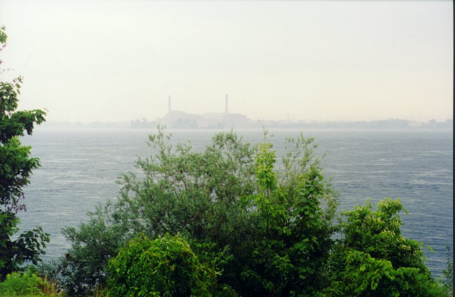
I parked under the shelter of the Peace Bridge at 16:35. The structure of the bridge gave me a dry space, so I was able to unpack my camera, change film and take some more pictures. I had a good view of Lake Erie, although it was very hazy on account of the rain and I could not see too far. Here at the lake's edge, I could see the strong current leading into the Niagara River.
| Fort Erie: Looking out on Lake Erie through the rain | |
|---|---|

| 
|
| Fort Erie: Looking across on Buffalo |
|---|

|
I spent about ten minutes under the shelter of the bridge before riding along the riverside park that last couple of kilometers to Historic Fort Erie itself. By the time I got to the fort, the weather was beginning to clear up a bit, and I was able to get a few photos. Alas, I missed a great shot of some re-enactors in period red coat uniforms. I was only able to peer in at the gate, as one had to pay admission to get inside.
| Fort Erie: Looking back on International Bridge |
|---|

|
I checked out the business area close by. There was one main street, with businesses and malls on both sides. I went into Zellers and bought some more film (I was on my last roll) and some dry socks and a Thank You card for Sheryl. I stopped at Tim Horton's and got a coffee and a whole wheat bagel. On a hunch, I called Sheryl. She had just gotten off the QEW in Fort Erie, so using my city map I gave her directions to Historic Fort Erie. I then set off, my coffee in hand, to meet her there.
When I got to the Fort, there was no Sheryl. It seemed odd. I had expected her to get there before me. Then she phoned. She had gotten a bit turned around. Together, I located her position on my map, and then gave her new directions. She came on a few minutes later.
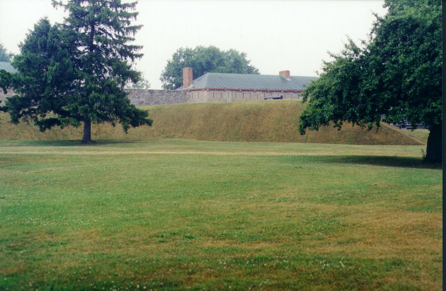
| Historic Fort Erie | |
|---|---|

| 
|
| Historic Fort Erie | |
|---|---|

|  |
It was 17:00 when I called Sheryl, who said she would be starting out soon. I then rode back up to the bridge area and got a photo of the Peace Bridge customs area from the overpass. Many times had I passed over this bridge.
| Fort Erie: International Bridge Customs Area |
|---|

|
I checked out the business area close by. There was one main street, with businesses and malls on both sides. I went into Zellers and bought some more film (I was on my last roll) and some dry socks and a Thank You card for Sheryl. I stopped at Tim Horton's and got a coffee and a whole wheat bagel. On a hunch, I called Sheryl. She had just gotten off the QEW in Fort Erie, so using my city map I gave her directions to Historic Fort Erie. I then set off, my coffee in hand, to meet her there.
When I got to the Fort, there was no Sheryl. It seemed odd. I had expected her to get there before me. Then she phoned. She had gotten a bit turned around. Together, I located her position on my map, and then gave her new directions. She came on a few minutes later.
| Destination: At the Gates of Fort Erie |
|---|

|
We took a few photos in front of the Fort Erie gates, and then she followed as I rode down to the waterfront parking area where We took some more photos. We spent about an hour down there as Sheryl went plant exploring while I did the final unpack of my bike and securely loaded it onto the car.
| Destination: At the Lake Erie shore | |
|---|---|

| 
|
| Destination: Closeup |
|---|
|
|
| Fort Erie: Looking across on Buffalo | Fort Erie: Looking out on Lake Erie Clearing weather |
|---|---|

| 
|
| Fort Erie: Riverfront Park | Fort Erie: Sheryl explores the plants |
|---|---|
| 
|
| Fort Erie: Sheryl by Lake Erie |
|---|

|
It was 18:30 when we were ready to go. We decided to eat there in Fort Erie. We were hungry already and felt no need to drive all the way back to Niagara-on-the-Lake where we would then pay double for whatever we ordered. We scoped out the local restaurants and settled into the Black Creek Tavern. I had a great roast beef dinner and Sheryl had liver and onions. The whole ceiling of this bar was hung with these cheesy party decorations, one hanging about every six inches.
| Fort Erie: Buffalo view in sunset |
|---|

|
After dinner, we took a leisurely drive back to Niagara-on-the-Lake via the Parkway, and I gave Sheryl a running commentary of my day, in reverse. She had a chance to look out on the Falls as we drove by.