| Trip Plan: Day 3: May 22 |
|---|
 |

Roger Kenner
Montreal, Qc,
Canada 2008
| Picture Key | |||||
|---|---|---|---|---|---|
|
|
|
|||
| [Read More] about the Picture Key. | |||||
| Trip Plan: Day 3: May 22 |
|---|
|
I was up at 07:00, but breakfast would not be until 08:00, so I re-packed my paniers and then carried all my stuff down to the front balcony. I sat down to change my rear tire and ended up holding up breakfast a bit, as all had to wait for me.
| AlmaToit Breakfast |
|---|

|
Breakfast was served to the other two guests and myself in the dining room, while Jean-Guy cooked in the kitchen next door. The kitchen being essentially an open extension of the same room, Jean-Guy listened in on our table conversation, making comments where he felt appropriate. The other two guests were from France. Breakfast ended up being longer than usual, as we just talked and talked and talked. Jean-Guy served up an omelette, yoghurt, croissants, and a cheese plate. I was not finally on my way until 09:30.
Rather than retracing my original route through town, which would have entailed a steep hill to climb, I took a detour around the back of the tiny RiverBend neighbourhood where the B∓B was located. Jean-Guy suggested I would find the old homes very interesting and that the climb was much less strenuous. I came out by the paper mill and followed the railroad tracks back to the main road. I then rode around behind the shopping centre and followed the familiar back streets to the bike trail entrance of the bridge spanning the gorge of La Grande Décharge.
| Alma Downtown 3 - Leaving | |
|---|---|
| Street Map of Alma | |
| Alma: Prominent Factory |
|---|
 |

|
I managed to get the photo I had missed the day before. Climbing up the far side, I got some more photos of the park around the touring information centre. Alas, there was no vantage point for getting any photo of the dam.
| Alma: Bikepath over La Grand Décharge | Alma: Bridge over La Grand Décharge |
|---|---|
 |
 |
| Alma: La Grand Décharge-Looking Downriver |
|---|
 |
| Alma: La Maison des Batisseurs |
|---|
 |
| Alma: Tourist Information Park |
|---|
 |

|
| Alma: Parc des Batisseurs |
|---|
 |
Rather than follow highway, as I had on the way in, I stayed with the bike trail as it curved away from the road. Thus, I was now finally and officially on La Route des Bluets. The trail led me through the back streets of Delisle (10:10-10:15), at one time passing through a trailer park, and then along the back country roads through farming country. I would catch distant glimpses from time to time of the main road, further inland. Not only was I happy to be on almost deserted roadways, but I was also cutting off quite a distance.
At length, as I came up over a rise, I finally got a glimpse of the water again. I was treated to a great, panoramic view. Now well behind the dam, the waters of La Grande Décharge were wide and calm as a lake. These were already the waters of Lac-Saint-Jean, this part being a bay, cut off from the main body of the lake by many islands, almost like the Thousand Islands along the Saint-Lawrence. I imagine it was mcu different before all the dams were built. There must have been a thunderous gorge and these islands would have been hilltops.
| Alma:Above Dam - Factory |
|---|
 |

|
| Alma: View over the Grand Décharge Above the Dam |
|---|
 |
Just as I was riding up to the rise, I had a small accident. I had neglected to latch my bags against bumps and so, in bouncing over a small bump, I lost one of my new paniers. Sadly, the impact tore one corner a bit, and made a hole in the waterproof rain covering.
| Alma to Péribonka - 2005 |
|---|
| Véloroute 2005 Brochure |
The separate bike route rejoined Route 169 at 10:55, just before Saint-Coeur-de-Marie, after amalgamations the last ward of greater Alma. From the height of the highway, I continued to have great views out over the Thousand Islands. I finally crossed out of greater Alma at 11:30.
| Alma to Taillon Map |
|---|
| Alma to Taillon Map |
| Above Alma: View from the Main Road |
|---|
 |

|
| Approaching Saint-Coeur-de-Marie |
|---|
 |

|
| Approaching Saint-Coeur-de-Marie |
|---|
 |
 |

|
| Saint-Coeur-de-Marie |
|---|
 |
| Approaching Saint-Henri de Taillon: Lake View |
|---|
 |
| Looking Back on Alma from near Saint-Henri de Taillon |
|---|
 |

|
Upon reaching Saint-Henri-de-Taillon at 12:00, I pulled up behind the town church, built on a promontory overlooking the lake, and took a rest at the first official 'kiosk' of the "Véloroute" that I had encountered. The lake was wider now, but was still dotted with islands, so one could not see too far. Off in the distance, I could still see the white, steam plumes of the big paper mill as Alma.
| Welcome to Taillon |
|---|
 |
 |
| Approaching Town |
|---|
 |
 |
| Saint-Henri de Taillon |
|---|
 |
| Taillon: Veloroute Halte |
|---|
 |
| Lake View from Taillon | |
|---|---|
 |
|
| [See Original Photo] | [See Original Photo] |
| Lake view from St Henri de Taillon (2002 View) |
|---|
 |
I would once again leave the main highway, which veered inland to cut directly across the Peninsula of Taillon. I opted for the longer route which would take me into the Provincial Park and right down along the waterfront. I followed the 'Rang' as it headed through the residential section of town and then descended to run along the back side of a narrow spit of land which I knew held a beach on the other side. The spit of land soon became wide enough for only one row of houses, the driveways of these leading down to the road I was on. A vast marsh developed on my other side.
| Taillon to Péribonka Map |
|---|
| Taillon to Péribonka Map |
| Pointe-Taillon Map-Entrance |
|---|
| Map of Pointe-Taillon Entrance |
At length, there came opening where the Taillon River cut throught to the lake. The spit of land to my left ended, as did the road. Ahead was a wooden footbridge, built across the river. The Provincial Park began at the far side. There was a narrow wooden gate, almost like the paths one would find at a stock yard. This guided all pedestrians towards the toll station, which was closed. A sign indicated that we must pay anyway, and should report to the Ranger station at the beach.
| Parc Taillon: Footbridge |
|---|
 |
| Parc Taillon: Footbridge |
|---|
 |
| Parc Taillon: View from Footbridge | ||
|---|---|---|
 |
||
| [See Original Photo] | [See Original Photo] | [See Original Photo] |
| Parc Taillon: View from Footbridge |
|---|
 |
| Parc Taillon: View from Footbridge |
|---|
 |
| Parc Taillon: View from Footbridge |
|---|
 |
It was not too much further along to the main beach complex, the usual beach buildings at the centre of which was a brand new visitor's centre. There was a vast and deserted parking lot for cars (which would have come in via a different route, from the highway.) It seemed like there was not a soul around, but the visitors' centre was nevertheless staffed by a Ranger. Several other cyclists were moving through the park. I paid my fee and bought a detailed map of the park for later use.
Parc-de-Taillon: Park Fees
Park Map
While I was talking up the young girl who was the park ranger, my cell phone rang. It was Sheryl, calling for her regular Noon check-in. She reported that my friend Bernie was still there, having arrived at 02:00 in the morning and having talked with her until dawn. She was now off to Costco. Once I had finished my phone conversation, it seemed to me that the ranger's attitude was much more distant, her having heard me speaking English on the phone.
| Pointe-Taillon Map | |
|---|---|
| Pointe-Taillon Map | |
| Parc Taillon: Visitor's Centre |
|---|
 |

|
I left my bike and walked out onto the beach, out to the end of the spit of land formed by the wandering waters of the Taillon River. From there, looking back eastward, I could see strung out along the beach on the far side of the river all the beach homes I had passed behind earlier. Some brave people were already out on the beach, although it was a pretty cold day. The distant plumes of steam from the mills of Alma were still visible.
| Parc Taillon Beach: Looking Back Eastward |
|---|
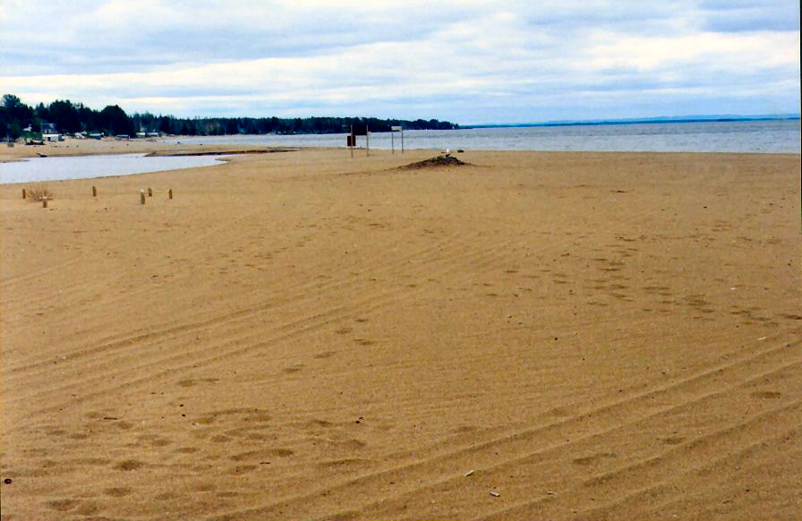 |
Looking the other way along the beach, all was deserted and empty. For the first time, I had an unobstructed view of the lake. Gone were all the islands! The waters of Lac-Saint-Jean stretched, unbroken across a 180-degree arc of the horizon. Only far off in the distance could one make out the distant shore and the mountains beyond.
| Parc Taillon Beach: Looking Westward |
|---|
 |
After my beach walk, I remounted and set off westward along the well-groomed, chipped stone bike path that ran just inside the tiny ridge behind the beach, offering continuous great views of the lake.
| Pointe-Taillon Map-Along the Shoreline |
|---|
| Pointe-Taillon Map |
| Parc Taillon: Bike Trail along Water's Edge |
|---|
 |
About one kilometre in along the trail, I stopped to sit on a log by the beach and have my lunch of hummus and crackers (12:45-13:00).
Parc-de-Taillon: Lunch from Cooler
Soon after I was on my way again. A look at the darkening tone of the overcast sky convinced me to stop (13:30: Km 4) and change into my canvas sneakers, so as to be ready for possible rain. The trail was already wet and the crushed stone offered a lot of resistace to the bike tires, making the going slow and difficult. In the end, though, only a few actual drops of rain would fall on me.
| Parc Taillon: Stop along Water's Edge |
|---|
 |
| Parc Taillon: Path through the Park |
|---|
 |
| Parc Taillon: Path through the Birch |
|---|
 |
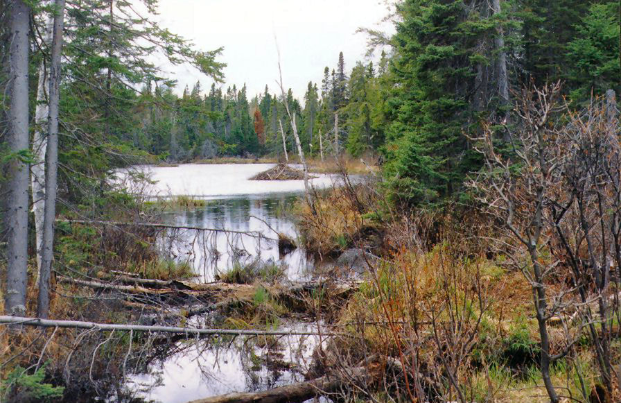
Although near the beach, the trail ran for the most part under a canopy of trees - sometimes pine, sometimes birch. The portions under the hardwoods were much lighter than those that ran under the pine, for the trees were just beginning to leaf out. It was very, very windy and I was thankful for the shelter of the trees. The wind could be heard whipping through the tops of the trees and was casting white caps out on the water. At length, two cyclists overtook me. These were the first I had seen, though I would see others shortly. The tracks of moose were everywhere.
I came upon lots of signs of beaver. Wooden beaver dams were built at every pipe leading under the pathway. Steel cages had been built out from the pipes, to keep the beavers from closing off the water flow completely.
| Parc Taillon: Beaver Lodge |
|---|
 |
 |
| Parc Taillon: Beaver Dam |
|---|
 |
 |
| Parc Taillon: Path through the Park |
|---|
 |
| Parc Taillon: Beaver Dam at Bridge | Parc Taillon: Beavers at Work |
|---|---|
 |
 |
| Parc Taillon: River Outlet to Lake |
|---|
 |
At kilometre 6 and 14:00, I came to the junction with the trail that cut across the peninsula. Had I wanted to, I could have taken the 30km ride all the way around the peninsula, stopping at a lookout point just across from Péribonka. Considering I had only succeeded in going a little more than six kilometres in the previous, with the wet gravel surface and the strong wind, going all the way around did not appeal to me.
I stopped at the junction for one last look out on the lake. The water looked very angry. Then I set out on the shorter path that cut across the heart of the peninsula. I passed three other cyclists, huddled in conference at the junction to decide their path. A bit later, one of these cyclists would overtook me, soon vanishing from sight along the trail ahead.
| Parc Taillon: Angry Lakefront | |
|---|---|
 |
 |
| Parc Taillon: Angry Lakefront |
|---|
 |
 |
Heading inland, I was very sad to came out of the forest cover and into the open tourbičre that formed the interior of the peninsula. There was no shelter at all from the strong force of the wind, and the wet gravel surface still dogged me. It would end up taking me 45 minutes to cover the next 8km.
| Parc Taillon: Path through the Pines |
|---|
 |
| Parc Taillon: Thinning Pine Woods |
|---|
 |
| Parc Taillon: Path across the Marshland |
|---|
 |
| Parc Taillon: Marshland | |
|---|---|
 |
 |
How wonderful it felt when I finally reached the trees again at the far side of the open marsh! Only two kilometres remained before rejoining the shoreline path. Alas, there was some serious payback in the form of a series of sharp, switchback climbs. When I reached the main path, I found myself atop a high ridge. I gather I was overlooking the Péribonka River, but I could only catch momentary glimpses of it through the trees.
It was 14:45 when I reached the shoreline path at 14:45 and 15:00 when I reached the park limit at 15:00. Development was visible along the shoreline at the very instant I left the park. Also, upon leaving the park, almost as if in answer to my prayers, the pavement started again. My legs felt immediate relief as my tires started to roll easily upon the hard surface. I still faced the wind, though.
| Leaving Parc Taillon | |
|---|---|
 |
 |

|
|
Another two kilometres along, I came to a crossroads. I could see my road ahead, climbing steeply up from the crossroads in two, steep succeeding ridges. Thankfully [Thank you, Jesus!], the marked bike path turned to the left and descended to the waterfront along a freshly paved road!
| Ste-Monique: Boats for the Péribonka |
|---|
 |
At 15:20, I was standing on a wooden pier which jutted out into the vast Péribonka River. The wind was fierce, kicking up whitecaps all across the wide body of water. (At this point, the 'river' is really an arm of Lac-Saint-Jean.) Looking upriver, I could see the continuation of the bike trail, running along wooden platforms built out along the water, at the foot of steep cliffs. It was a pleasant surprise and would provide a pleasantly flat ride. The cliffs would keep me sheltered from the wind and so the going would be fairly early.
| Ste-Monique: La Rivičre Péribonka Looking Downriver |
|---|
 |
| Ste-Monique: La Rivičre Péribonka Looking Upriver |
|---|
 |
 |
| Ste-Monique: Bicycle Trail along Cliffs of La Rivičre Péribonka |
|---|
 |
| Ste-Monique: Bike Trail Begins at Marina |
|---|
 |
| Ste-Monique: Bike Trail Along the Water |
|---|
 |
| Ste-Monique: Bike Trail Along the Water |
|---|
 |
Eventually, all good things must come to an end. The trail left the wooden platforms built out over the water and turned inland to climb up a narrow gully, alongside a gushing creek. The climb was hard, but manageable and I was, thankfully, I was still out of the wind. The sight and sound of the water rushing alongside refreshed me and gave me renewed strength.
| Ste-Monique: Climbing up the Creekbed |
|---|
 |
| Ste-Monique: Bridge over the Creek |
|---|
 |
| Ste-Monique: Welcome to Ste-Monique |
|---|
 |
 |
At the top of the gorge, I came out amidst the small town of Sainte-Monique. Besides the church and the town square, there was not much to Sainte-Monique. I stopped into the depanneur to buy some ice for my mini-cooler (15:40-45), then I was on my way, down the hill and out of town.
St. Monique, Ice
| Sainte--de-Honfleur |
|---|
|
|
| [See Original Page] |
| Ste-Monique: Heading on Down the Hill and Out Over the Bridge |
|---|
 |
I was surprised to find that the Véloroute had its own, new pasarelle over the Péribonka River, avoiding the highway bridge. Here, at the head of the 'bay' was the true river, a fifty-foot wide stream gushing over the rocks in true rapids., before emtpying into the calm water. I was just below the first dam on the Péribonka, but I could not see it above the highway bridge.
| Ste-Monique: Kilometer Zero! |
|---|
 |
I was also surprised to see that Sainte-Monique was the 'Kilometre 0' of the Véloroute. I would learn later, from some of my B&B hosts that it was the little town of Sainte-Monique which had started the whole thing. In fact, at the far side of the bridge, before rejoining Route 169, I passed across a small island which held another B&B, one of the prime-movers of the whole bike trail enterprise.
| Ste-Monique: Bicycle Bridge over Péribonka |
|---|
 |

|
| Ste-Monique: Bicycle Bridge over Péribonka |
|---|
 |
| Péribonka Bridge: Rapids at head of Estuary |
|---|
 |
| Péribonka Bridge: Looking out over Estuary |
|---|
 |
For once, the strong wind was at my back, so I raced along. The highway ran right alongside the river, giving me an unbroken view. I stopped briefly at a roadside rest area, just below the bridge, to get some photos. Then I let myself be pushed along. To my right were vast fields, still pretty much dormant. At first they were blueberry fields, but then that gave way to brown, cultivated furrows which would soon be potatoes. The far side of the river was an unbroken wall of forest.
| Halte Routičre along the Péribonka: View Upriver |
|---|
 |
| Halte Routičre along the Péribonka: View Across the River (At Start of Park) |
|---|
 |
| Halte Routičre along the Péribonka: View Downriver |
|---|
 |
| Approaching Péribonka: Fields of Nascent Blueberries! |
|---|
 |
I came upon a short section of dedicated bikeway as I crossed the Péribonka line, but the quality of the roadbed was so poor that I was happy to rejoin the highway. I could see the church spire of the town far up ahead as I came into it slowly. The first sign of town was simply the presence of more and more farm dwellings on the landward side. Then came farmer's coops and finally regular homes. I passed a museum dedicated to the author of the classic Maria Chapdelaine, which was set in this area.
| Péribonka: Bike Path on Outskirts of Town | Péribonka: Bike Path switches sides |
|---|---|
 |
 |
| Péribonka: Approaching town |
|---|
 |

|
| Péribonka: Not only blueberries! |
|---|
 |
I finally arrived at the town line of Péribonka at 17:15. Péribonka is, for the most part, strung out along the section of Route 169 that follows the river, beginning just at the point where the highway reaches the river. Most of the town is only one thickness of buildings wide. Only at the centre of town are there a few back streets. The town has a small, well-groomed marina at its centre. From this marina, one can look out through the mouth of the Péribonka River and see the open lake.
| Welcome to Péribonka! |
|---|
 |

|
| View towards Open Water from Péribonka Marina |
|---|
 |

|
| Péribonka: Looking back Upriver at Stormy Sky |
|---|
 |
| Péribonka: Strange Juxtaposition? |
|---|
 |
 |
| Lodging: Day 3: Péribonka |
|---|
 |
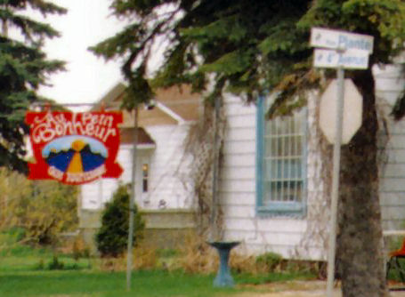
The B&B was in a small house, one block around the corner where Route 169 turned away from the river. It has a balcony and railing on two sides. One entered in the kitchen and passed through an archway into the living room. Carol was with his wife and children, who were everywhere. A tight little stairway brought one up to the second floor, where there was a single junction hallway off which were placed all the rooms. The guest room (at least one of them) was on the side of the house overlooking the side street. It was a tiny, narrow room, with the roof pitched over the bed. One could get enough head room to stand at the right-hand side of the room. The old, brass bed took up most of the room, except for the narrow walkway and bedroom furniture against the wall. An old-fashioned sash window looked out over the street below at the far end. Wallpaper from my grandmother's era covered everything. In fact, I was reminded greatly of my grandmother's house outside of Antigo. They had built a small bathroom in the closed, just to the left of the entrance door. One climbed up a step into this tiny room, complete with toilet, sink and tiny shower. Fitting all this into the tiny space must have been quite an art.
| Péribonka: B&B |
|---|
 |
 |
| Péribonka B&B |
|---|
 |
| [Qtourist Guide 2005 B&B] |
Sunday, May 22: Alma to Peribonka: ~ 75km Lodging in Peribonka Aubergite au Petit Bonheur 374, rue Plante 418-374-2328 re: "Carol" $40 |
| [See Original Document] |
When I got to the B&B, Carol and family seemed a little discombobulated. Though I was expected, the room was not yet made. Amidst the chaos, I unpacked my bike and locked it to the balcony railing; brought in my stuff; changed into my evening clothes, jeans and shirt; and then left to get something to eat.


B&B at Péribonka
I quickly learned there was only one restaurant in town, a fancy Moroccan place just across the street. Le Restaurant L'Ancestral had nothing on their menu but a table d'hote at $39.00 I could not believe it, but I had little choice. It was that or not eat! I was the only customer in this fancy restaurant. As I sat by the window overlooking the lake, I took my good, sweet time with my fancy soup, sald, rice and pastries filled with meat and cheese. I had a couple of beers. When I was still hungry, the owner gave me a second helping. It only seemed just considering what I was paying. The total would come to $50.50, more than I had ever spent on just myself. In all the time that I was there, no other customers came into the restaurant.
Peribonka, Supper
| Restaurant L'Ancestral: Péribonka: Very Expensive Eatery! |
|---|
 |
It was near dark when I left the restaurant. I walked over to the marina to enjoy the night air as I looked out on the river. I took the occasion to check in with Sheryl back home. My call was picked up across the lake.
| Péribonka: Boardwalk |
|---|
 |
The dark, pregnant skies soon began to let loose a drizzle, which soon changed to rain. The rain drove me back to the B&B, where I went upstair to my room and wrote for a while before retiring.
On to Day Four Top![[See Original Photo]](./Pics/Vdt05a_03_018.jpg)
![[See Original Photo]](./Pics/Vdt05a_03_019.jpg)
![[See Original Photo]](./Pics/Vdt05a_03_023.jpg)
![[See Original Page]](Keeps/Tour11_Taillon_Qtourist_LStjean2004_5.jpg)
![[Qtourist Guide 2005 B&B]](Keeps/BB03_Qtourist_LStjean2004_5.jpg)