

Return to Menu
(See Copyright Notice on Menu Page)
Foreword
It was the long weekend at the end of the Summer and I set off on a two-day ride towards Ottawa. The first portion of this ride would take me along now familiar routes as far as the town of Hudson. Then I would revisit for the first time since 1993 by bicycle, the towns of Rigaud and Pointe Fortune.
This excerpt only covers in detail that portion of the ride. Read the full text account of the Ottawa Bike Ride which is included as an auxiliary file.
Montreal to Dorion
| Vaudreuil to Hudson | [Map Removed] |
|---|
On the Ile Perrot side, a new, tiny green bicycle sign pointed the way to a shortcut leading from the bridge to connect with the northern route across the island. Thus, I did not have to ride all the way to the first light before having to double back. I rode quickly across the northern route, the trees sheltering me a bit from the wind. I had a few false starts at the far end before finding the right street to cross back over the tracks. I think this may have only been the 3rd time I have ridding this route, and only the second time going westward.
I rode under the Hwy 20 interchange and around by the shopping centre to connect with the bike path across the second bridge, which is on the south side. This bike path leaves on the wrong side of the road once into Dorion. I had to ride along sidewalks and through parking lots before I got to the first light. Even with the light, getting across the 20 was difficult. When my light was green, I was cut off by the two lanes of traffic turning left onto the 20. It took a couple of lights before I got my timing right, setting out just as the through traffic was slowing for the yellow light.
As I rode along St. Charles Boulevard through Dorion and into Veaudreuil, I quickly noticed the effect of my change in direction. I was now headed northwest and directly into the teeth of the wind. Once into the commercial area near Hwy 40, I made a 15-minute stop at Tim Horton's for a coffee and a bagel. I decided not to wait until 12:00 to call Sheryl, but to call her from a pay phone so as not to deplete the remaining charge on my cell phone.
| Looking west on Hwy 40, towards Ottawa |
|---|
|
At 11:30, three hours into the ride, I was atop the Hwy 40 at Veaudeuil (+10km=38km).
| Country road comes into civilisation in Vaudreuil | Looking on, south towards town of Vaudreuil |
|---|---|
 |
 |
Not far off the far side, I was able to turn onto Chemin de l'Anse and finally escape from the urban setting. Normally, this would be a very pleasurable part of the ride, as the road makes a large curve around the cove and there is only a single row of lakefront houses on one side and the open water on the other. On this sunny but mercilously windy day, though, the open water offered no resistance at all to the strong wind. As I slogged along, waves were hitting the shore. I bought some relief as I turned the corner and the wind was partially blocked by the trees.
| Road curves around cove, right by water |
|---|
 |
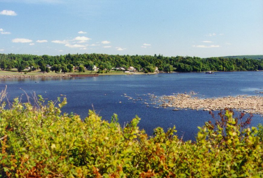
| Vaudreuil: Lake of Two Mountains from Chemin de l'Anse |
|---|
 |
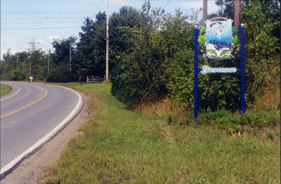
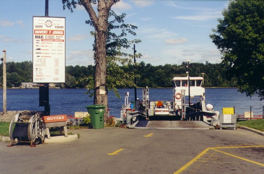
At 12:30, four hours into the ride, I was the Hudson side of the Oka/Hudson ferry (+7.5km=45.5km)
| Hudson: Welcome to Hudson | Hudson: Hudson/Oka Ferry |
|---|---|
 |
 |
| Hudson: Fall Foliage along Road in Hudson |
|---|
 |
West of the ferry, to Hudson, I had only cycled twice, first in the early 1990s and then again when I made my first Oka/Hudson tour in 1997. I rolled through the centre of Hudson at 12:45. Past the ferry, the road undergoes a number of undulations as one crosses over the ridge connecting the highlands of St. Lazare with the Two Mountains. Compared with the wind, I felt nothing from climbing the hills.
| Hudson: Main Street in Hudson |
|---|
 |
| Hudson to Pointe Fortune | [Map Removed] |
|---|
At 13:00 I was even with Finnegan's Marker, where Sheryl and I have come many times for shopping. It was packed, as usual. (A ride to Finnegan's Market would thus take me four to four and a half hours, depending on the wind.)
| Hudson: Finnegan's Market | |
|---|---|
 |
 |
| Hudson: Road beyond Finnegan's Market |
|---|
 |
Finnegan's Market is on the downslope of the hills around Hudson. The road opens up into farmland again and flattens out. Just across the Hudson line was a big, new condo-apartment development called 'Hudson' something-or-other. It is precisely by keeping these sort of developments out that Hudson has remained as Hudson is.
| Hudson:
Road beyond Finnegan's Market: Looking Inland towards Hills |
Hudson:
Road beyond Finnegan's Market: Looking Out on Lake of Two Mountains |
|---|---|
 |
 |
At 13:30, five hours into the ride, I was at the junction of Main Road (in Hudson)/Chemin de l'Anse (on either side of Hudson) and Route 342 (+13km=58.5km). I followed Rte 342 on into Rigaud, the centre of which I reached at 13:50.
| Rigaud: Onto Rte 342 - Approaching Rigaud | (Closeup) |
|---|---|
 |
 |
| Rigaud: Welcome to Rigaud | |
|---|---|
 |
 |
| Rigaud: River - Looking Upstream | Rigaud: River - Looking Downstream: Old Rail Trestle |
|---|---|
 |
 |
| Rigaud: Monastery along River |
|---|
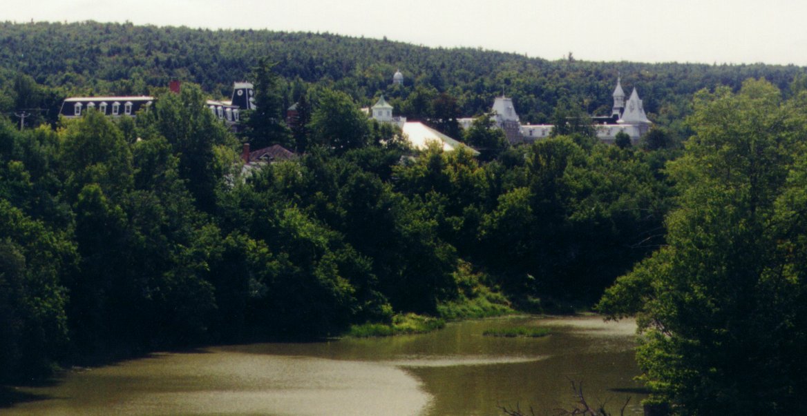 |
| Rigaud: Looking Back on Town from Hwy 40 Overpass | Rigaud: Historic Church |
|---|---|
 |
 |
I stopped for a couple of minutes to get some pictures and then headed out, still on Rte 342, towards Pointe Fortune. At 14:00, I was atop the overpass of Hwy 40, as it headed towards Ottawa. I stopped there briefly to open my cooler and have some grapes and cheese while watching the traffic. Heading off after, while pushing along the high curb with my feet to get forward motion, I took a tumble, right down to the ground. I was lucky I did not get scraped or damage anything on the bike.
| Rigaud: Hwy 40 Overpass - Looking East | Rigaud: Hwy 40 Overpass - Looking West |
|---|---|
 |
 |
| Rigaud: Closeup from Hwy 40 Overpass |
|---|
 |
| Rigaud: Mountains from Hwy 40 Overpass |
|---|
 |
I passed a sign just past which announced that Pointe Fortune was 10km away. It was 14:10 when I passed the sign and would be 14:50 when I reached Pointe Fortune. Thus, it would take me 40 minutes to go 10km, or 4 min/km
| On the Road towards Pte Fortune |
|---|
 |
I passed by the campground where I had overnighted during my early 90s visit. I also passed by the farm where Sheryl and Alex and I had gone rasberry picking not too many years ago.
| Pte Fortune: Campground from 1993 |
|---|
 |
At 14:40, six hours into the ride, I was halfway between the campground and where the road splits to lead off into Pointe Fortune proper (+10km=68.5km).
The road splits, with Route 342 going on to join the freeway at the border and a small road leading down into Pointe Fortune. I reached Pointe Fortune at 14:50. I was fortunate (pun intended) to find a pay phone right outside the casse-croute at the ferry. Montreal was surprisingly still a local call, so I called Sheryl, who was out with her teacher and students from Ottawa. I still had no firm idea what I wanted to do, but I realized I would only make it to Hawkesbury that day. I promised to call again at 17:00. I ordered some fries at the casse-croute and quickly consumed them. I was ready, then, to set out on the discovery portion of my trip.
| Welcome to Pte Fortune | |
|---|---|
 |
 |
| Pte. Fortune: View Across the River |
|---|
 |
| Pte. Fortune: View Into Town | |
|---|---|
 |
 |
| Pte. Fortune: Ferry Crossing from Carillon | |
|---|---|
 |
 |
| Pte. Fortune: Ferry at Dock |
|---|
 |
The ferry at Pointe Fortune is as far as I had ever ridden in this direction. In fact, when I was last there, I had not even ridden up to the dam on the south side, and had not discovered until later that a small portion of the town is actually in Ontario.
| Pte. Fortune: Ontario Border - Looking back on Pte. Fortune |
|
|---|---|
 |
 |
| Pte. Fortune: Ontario Border - Looking West |
|---|
 |
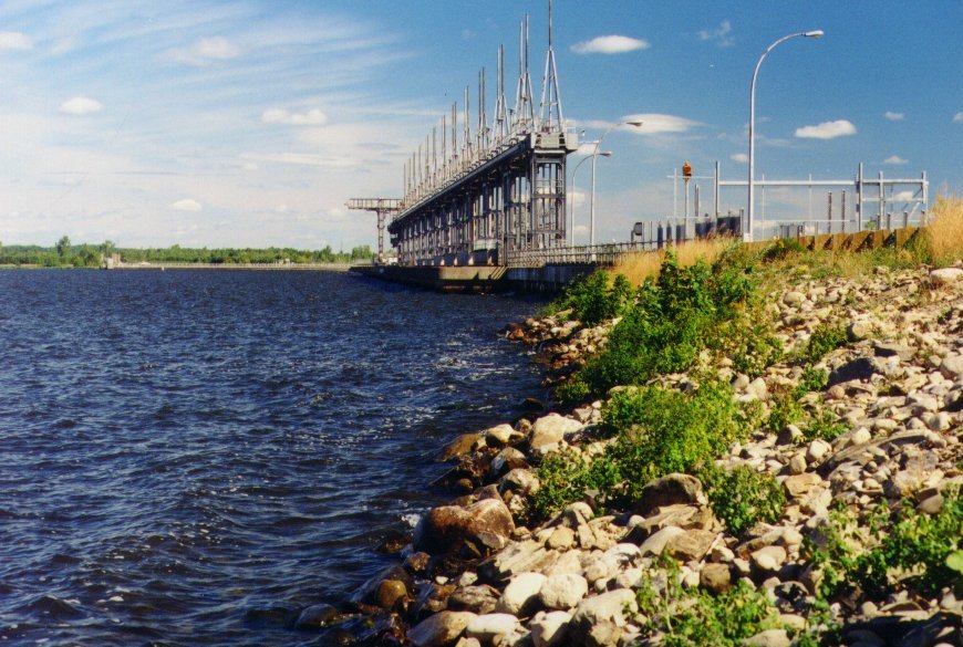
| Road Across Dam Crest - Is there a way through? | Pte. Fortune: Dam at Carillon |
|---|---|
 |
 |
| Pointe Fortune: Lake and Dam from Causeway | Pointe Fortune: Causeway towards Park Voyageur |
|---|---|
 |
 |
| Pointe Fortune: Downriver from Causeway | |
|---|---|
 |
 |