Starting Out
So, this morning was the moment of truth - the day to set out. I did so with great trepidation and with aches in my knees and ankles. I had begun packing the bike on Friday - and completed it yesterday. It's as light as I've ever had it, but it still weighs like a truck. The tent, air mattress, and sleeping back make up half the weight.I got up this morning at 5:30 and was down for breakfast at 6:30. Sheryl made me bananas and sour cream, which she said was a good breakfast for this sort of thing. Last night I carbohydrate loaded with a healthy serving of pasta.
After taking some departure photos, I was off at 07:00. I rode my habitual route to Ville St. Pierre, along Monkland & Sherbrooke to Montreal West, over the tracks on Westminster, and down the hill on St. Jacques. I made a left turn on Chemin Ville St. Pierre and went under the Hwy 20, across Notre Dame, and to the Canal bridge. Instead of taking the Canal bikeway though, I continued straight.
| Starting Out: Monday July 17 07:00 | |
|---|---|

| 
|
I then had my first mishap. As I geared down in front, to climb the hill, my chain slipped off. Luckily it did not get caught. I shall have to adjust that front derailleur
I climbed up along the bike path, where the main boulevard used to be, and then came out on Lafleur, along which I continued across the town of Lasalle. I then crossed the bridge over the highway and rode down Stinson to the almost hidden entrance to the sidewalk on the Mercier Bridge. I had checked out the sidewalk a few days earlier, to make sure it was still open, on account of road work. It was, sort of.
| Crossing the Mercier Bridge |
|---|

|
As I rode along this very narrow sidewalk, with no divider between me and the cars zooming by at 120+ km/h, I had my usual "crossing the Mercier" fear. The view was stupendous, and it was a clear, sunny morning. It was 07:30 when I reached the bridge, and it took me 10 minutes to cross it. As I neared the construction, I tried to ride by the first of these signs they had stuck right in the middle of the sidewalk. As I rode by, I clipped the sign, cutting my arm and almost going off the sidewalk. I was very scared. After that, I stopped at each sign to walk my bike around. There comes a place, just past the crest of the bridge, where the road splits. Of course, I needed to go to the left. I stopped and put my bike down on the roadway next to the sidewalk and re-mounted. I looked back to the crest and counted 6 seconds from the time I saw a car until the time it passed me. I waited. At the right moment, when I saw no cars, I made my move. I had to cross the two lanes heading to the right before I got onto the left ramp. Once onto the ramp I was okay, even though there was no longer a sidewalk and I was on the roadway. As I descended the ramp, I quickly picked up a very respectable speed.
Across Southern Quebec: To Napierville Crossing
It was 7:40 as I rolled down off the ramp and onto Route 132 in Kahnawake, heading east. Route 132 there has a wide shoulder, so I was okay even though the traffic was heavy with a lot of semi-trucks.At 7:55 I was at the Ste. Catherine town line and leaving Kahnawake. Right at the line, the Hwy 30 freeway dumps its traffic from Chateauguay onto Highway 132. Thereafter, on both sides of the road, are strip malls and new housing developments, more even than I had noticed last time I was by that way, back in 1998.
At 08:00 I passed a sign which indicated 7km to Hwy 15. By 8:13 I had reached the Delson town line and by 8:20 I had covered 6 of the 7 km. Six kilometres in 20 minutes: For about 18km/hr. The way was flat and I was riding in the middle sprocket in front and the middle, with plus or minus one, sprocket in the back.
At 8:20, I turned off Route 132, just shy of Highway 15, onto Chemin St. Francois-Xavier, towards St. Mathieu. As soon as I turned, I met a strong headwind. I was now cruising on the middle minus one gear in the back, and only got to the middle occasionally, when sheltered from the wind by some trees or on a slight downhill.
At first there was lots of traffic and a lot of trucks on the narrow road with crumbling shoulders. Once I was clear of Delson's industrial park, though, the traffic lightened.
By 08:30, about ten minutes after starting on this road, I was out into the country, riding through corn fields and by farms. I rode by the big Lafarge Cement Plant, whose smokestack can be seen for miles, and saw for the first time the Hwy 15 freeway, curving down from the east. The low line of clouds off to the west was resolving itself into an ever greater presence. I wondered how the wind could be dead from the south and yet the clouds could be approaching from the west.
| South of Montreal on Chemin St. Francois-Xavier Looking back at the Cement Plant |
|---|

|
| Note the blue sky. To the west, the oncoming clouds looked equally as innocent. |
At 08:40 I made the St. Mathieu town line. At the entrance to the Lafarge plant I stopped for a P-break in the bushes.
At 09:00 I was in St. Mathieu's town centre, by the church. (In 1993 I had eaten lunch under the trees in front of this church.) I turned on my cell phone, as I had arranged the following "on-air" schedule with Sheryl: 09:00-09:30, 12:00-12:30, 15:00-15:30, 18:00-18:30.
I had ridden past the church and turned to the left along Chemin St. Edouard, stopping for a break at a small bridge over the tiny creek running through town, when Sheryl called. It was 09:10, and I was still well within sight of the church. We only talked for a couple of minutes, just to touch base. Then I had my first granola bar, washed down with a healthy squirt of water, before continuing on my way.
By 9:20 I had reached the St. Edouard town line. I was watching for the turn off to Rang des Sloans. I had learned of this shortcut in 1993, coming home. Going out, I had followed the main road into St. Edouard and had found that afterwards I had to ride far out of my way to the west and had to climb a long, useless hill, only to ride down the other side.
At 9:25 I came to Rang des Sloans. For a good part of the way, it parallels the main road, but on the east side of a tiny river: Riviere de la tortue. Farms on either side of the river separated the two roads. Rang des Sloans had next to no traffic. It wound its way around farms and individual private country dwellings. At times it ran almost right next to Hwy 15.
By 09:50 I was even with the town centre of St. Edouard. I could see the church steeple a couple of kilometres to the west. By now, the main road was no longer parallel, but had begun its wide swing to the west. The farms gave way to scrub-like forest on either side.
Just after crossing a railroad line, the road climbed what was a pretty hefty hill for the flatlands. At the top of the hill, at 10:00, I took another 5 minutes break. In the near complete absence of cars, I could hear the insect and bird sounds of the trees. A distant train whistle announced a train running along the tracks I had just crossed. I could hear the engines and the sound of the wheels on the track. There was also the distant roar of traffic on Hwy 15, hidden by the trees but less than a kilometre to the east. The first streamers of the oncoming clouds from the west were already beginning to block the sun. I parked my bike and got off to rub and massage my aching knees. I had my second granola bar and another healthy serving of water. I snapped a photo of the location. Then I was on my way.
| Rang des Sloans: The Hill |
|---|

|
| I had just climbed up this hill. Note how quiet the road is The farms had given way to forest. |
I was surprised at how fast I came on to the main road. Just after my break, Rang des Sloans turned a corner and I was back out into the open. It came to and end as it joined Rang St. Jean, a short almost suburban-like street, with newly built houses along both sides.
I came to Route 221, Rang Ste. Marguerite, at 10:20. It had taken me an hour and twenty minutes to ride along shortcut. I turned east along Route 221, which was a much busier highway. It was to be the road on which I would cross to the east side of the Hwy 15 freeway.
I stopped at the top of the overpass to take a photo of the highway and countryside. Then I saw how black were the clouds that were bearing down on me. I decided it was time to seal the camera and field glasses into their plastic bags and to stow them away. I got my rain poncho and rain shoes out from the saddle bags and replaced them with my regular shoes, duly encapsulated in a zip-lock baggie. My rain shoes were canvas tennis shoes that would dry out quickly.
| Napierville: Crossing the 15 |
|---|

|
Across Southern Quebec: Down the East side of Hwy 15
Then I came down off the bridge. At the Route 221 interchange is a small town-like combination of gas stations, convenience stores, and a motel, just 2km short of the town of Napierville. I had no need for a store this day, though I toyed with the idea of stopping into one of the depanneurs to get some aspirin, for I had a slight headache. I decided, though, that my headache was not that bad and so I passed the stores by.I turned south onto Rte 217, continuing to parallel Hwy 15 but now on the east side. Very soon I was out of sight of the highway and I could no longer even hear the traffic. I rode though more farmland.
At 11:00 the rain started. I donned my poncho and kept rolling on past the farmhouses and small private country dwellings. Like Rang des Sloans, Route 217, or Rang St. Andre, was nearly devoid of cars. There were some mild ups and downs, but I never had to leave my middle gear in front. I did often have to go into my easiest gear in back though, as the headwind was still strong and added to the force of the rain.
At 11:15 I crossed the Lacolle town line. I crossed an abandoned rail line which had been turned into a gravel bike path, leading off to the east. By 11:30 I was even with Lacolle town centre, which was 3km to the east. The hills were getting higher and higher and the countryside was becoming more wooded. There were fewer and fewer farms, but there was a constant line of private houses on large plots of land. I was never really out in the empty countryside.
At 11:45 the rain mercifully stopped, though it was still overcast and windy. I took off my poncho and stored it on top of my gear in the back, for easy retrieval if necessary.
I crossed a main highway, which I later realized was Route 202. At the time I was mistaken about my location, and since it had been raining, I had not taken out my map. In 1993 I had discovered that just shy of the border, Route 217 ended, and it was necessary to follow a main road, Chemin Guay, to the east in order to find a road going across the border. I thought I was in that same spot, and the sign showed Route 217 to continue. Soon along the way, I came to brand new pavement, which only reinforced my mistaken notion. There were fewer houses and they were further apart, and I came upon some fairly large farms. I expected the border to come up at any moment.
At 12:00 I turned on my phone and Sheryl called almost immediately. The connection was not great, but we could communicate. I told her I was almost at the border, and that I would call her again as soon as I got across (for she was waiting to go out.) While I was talking to Sheryl, it started to rain again and I had to put on my rain poncho.
I rode along another couple of kilometres. I passed the farm of our pig farmer acquaintances from Scottish dance class, where we had gone for supper back in 1995. I still expected to see a border crossing at any moment. Then, coming up over a rise, I came down to another main road. At the far side was a sign indicating that Route 217 ended. It was then that I realized my error, and knew that nothing had changed since 1993.
This was at 12:15. turned east onto the main road, Chemin Guay. There was a long, gradual hill to climb up, as the road curved gently to the north. Coming up over the rise, I met up with Route 221 and turned south. I was 3km from the border.
Into the United States: New York
| Detail: Champlain to Plattsburg, N.Y. |
|---|

|
I rode on quickly and found myself on the back streets of Champlain, New York. Though everything looked flat I was in my easiest gear in back and was pushing hard. The rain stopped and the sun came out abruptly. Suddenly it got very hot. I stopped at a tree in someone's front yard, where I propped up my bike. I doffed my rain poncho and wrote some notes in my notepad. Then I called Sheryl to tell her that I was across. The connection was very bad. It was 12:45.
Refreshed and cooler, I rode on through suburbia, enjoying the tiny spot of sun. I could still see big, black clouds gathering all around.
At 13:00, I connected with U.S. Hwy 11, running east and west between Rouses Point and Champlain, New York. I turned right, west, towards U.S. Hwy 9. I had toyed with taking the smaller roads that went down by the lakeside, roads that I could now identify because I had good maps. (Back in 1993, I had missed these roads as my map did not have enough detail to show them.) This day, I decided I would rather have lunch, and I knew I would not find it on tiny back roads. I guessed that I would find a restuarant at the junction of Routes 9 & 11.
The distance was one mile. This mile, however, included a long descent, down to the bridge over the Great Chazy River. This was followed by a long, slow climb back up to the highlands. The climb was gradual enough that I did not have to shift into my "granny gear" in front.
At 13:15 I came to the four corners, and found a fairly good sized shopping centre to my right. As I scanned the storefronts, I was pleased to find a restaurant. I carefully parked my bike in front, and then took a seat at the counter where I could keep an eye on it.
I must have looked like some character, wet from the rain and then sun-dried. My shoes were still squilching. After I ordered, I went outside and wrung out my socks and put them back on. It felt much better. Thank God for woollen socks! It may have been because of my unkempt appearance that the girl who served me did not really seem too friendly.
The soup-of-the-day was Hamburger & Vegetable soup. It was a weird combination, but certainly tasted good. I also ordered a mini-pizza "deluxe", with sausage, hamburger, etc. It was a bad choice. The pizza was not very good and was very soggy. I did not eat the whole thing. I devoured a root beer and several glasses of water. For dessert, I had coffee and a chocolate chip cookie.
As I was eating, the sun went away and it began to rain again. It was still raining when I set out at 14:00, after my 45 minute stop. I headed south along U.S. Hwy 9. The sign indicated that Plattsburg was 21 miles. New York's main roads have wide, paved shoulders (nearly six feet wide), which makes for very nice cycling. Hwy 9 follows the high ground, and I got occasional glimpses out over the rain-soaked valley of the Lake.
At 14.25 I came to the junction with Route 9B, coming down on an angle from Rouses Point. Had I continued straight upon reaching Route 11, instead of turning west for food, I probably would have come out here. At about this time the rain stopped, so I stopped for a break and stowed my poncho. The sun did not come out this time.
| Chazy-New York |
|---|

|
I was at the Chazy town line by 14:35. At 15:00, I put my cell phone on, as arranged. Sheryl called at 15:15, as I stopped by a photo of the lake. This was a point where the vista was not blocked by trees, and one could normally see out over the whole valley. On this day, I could barely see down to the lakeshore, which was quite a bit lower than I was. Looking across the lake, everything disappeared into a blue-grey haze. I heard thunder as I was taking my photo.
| First view out over Lake Champlain |
|---|

|
I started to watch this big, black cloud line as it approached from the west, coming ever closer. I could see the end of it, and sort of hoped that I might get past. As it came nearer and nearer, however, and I could see the lightning bolts in the dark blue haze, and hear the cracking thunder, I lost that hope.
It was 15:30 and I had just crossed the Beekmantown line. I was well out in the open and felt very exposed. I certainly did not want to ride through a lightning storm out where I was. I rode quickly and scanned ahead, looking for any shelter. I saw a traffic light up ahead, and hoped that there would be some activity around it. Luckily, I found this lodge: "Mi Casa" in Beekmantown. I rode it and was about to go into the lobby and ask to sit out the storm when this youth of about 16 approached and asked me if he could be of assistance. I told him I needed shelter from the storm and he invited me to bring my bike into the garage.
It was 15:45 when I stopped, and would be 16:10 before I got on my way. I stood for a few minutes at the open barn door, watching the last few minutes of the storm's approach, as it got blacker and blacker and the wind howled. Several other youths had gathered and were talking me up about my trip. When the storm finally hit, I was glad I had made my choice to wait it out, and thankful God had given me a good shelter. The rain was ferocious and lightning bolts were striking all around.
It was still raining when I left, but the worst was over, and the sky had lightened up. As I rode on down the road towards Plattsburg, the rain finally stopped. I was able to take off my rain poncho yet again.
Arrival in Plattsburgh
| Plattsburgh-New York |
|---|

|
I was actually stopping for the day well shy of Plattsburg town centre. I turned left at the first traffic light, right at the edge of town, and followed the road back along the lakeshore towards Cumberland Head (where there is a ferry to Vermont). About a mile down that road I came to Cumberland Bay State Park. I did not expect there to be a camping problem on such a rainy day, and I was correct. I had my choice of sites. (I had actually made a reservation at Plattsburg RV Park, for Cumberland Bay would not take reservations for only one day. This policy is commonplace and makes life very difficult for touring cyclists, who cannot easily go somewhere else if the park is full. Despite my feelings on the subject, I chose the State park, as it was much nicer for tenting, and was right on the water.)
| Camping: First Night: Cumberland Bay | |
|---|---|

| 
|
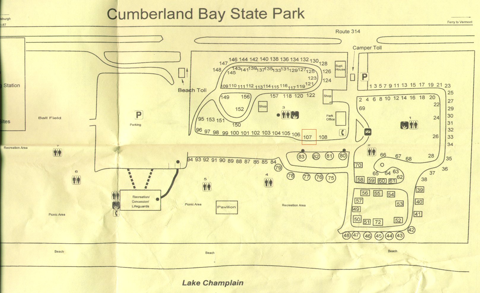
| Campground map: Site # 107 |
|---|
|
| Campground: Day 1: Plattsburgh | Huge Thunderclouds |
|---|---|

| 
|
By 18:00 my tent was all set up, in site #107. I sat on a bench by the beach and was watched the big thunderclouds out on the lake. There was a short sun shower, but then I was treated to clear sky as the sun angled down to the west, casting a golden light on everything. My cell phone was on and I was waiting for Sheryl's call. It was very relaxing listening to the small waves washing up on the beach.
| Plattsburgh Beach at Cumberland Bay | |
|---|---|

| 
|
| Supper & Breakfast Days 1 & 2 |
|---|
|
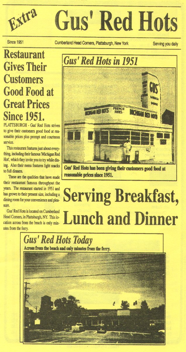
I rode back to the traffic light, where I remembered a good restuarant from when I had been here in 1993: Gus's Red Hots. I parked my bike outside and took a booth at the window right by it.
I had turkey soup, followed by a hot turkey sandwich, with Root Beer and then coffee. I ate slowly, as I wrote the days events in my journal. The restuarant closed at 20:00 (I was surprised at how early), but they let me stay until 20:30.
I rode across to the depanneur (convenience store) and bought myself a bottle of orange juice for the tent. Then I rode back to the campground and got myself all settled in. I spent a few minutes rubbing onto my aching knees and ankles the special oil that Sheryl had made for me. Then, I placed a final call to Sheryl from my cell phone at 21:45, just before lights out.
I did not sleep well that night. I could not get comfortable. The blow-up pillow I had brought just would not fit right with my neck. I ended up getting about 3 bouts of sleeps, of perhaps two hours each.