| Trip Plan: Day 5: May 24 |
|---|
 |

Roger Kenner
Montreal, Qc,
Canada 2008
| Picture Key | |||||
|---|---|---|---|---|---|
|
|
|
|||
| [Read More] about the Picture Key. | |||||
| Trip Plan: Day 5: May 24 |
|---|
|
My watch alarm went off at 07:00 as planned. The sun was streaming in through the windows, offering the hope of the first sunny day of my ride. I got dressed for the day's cycling and repacked all my bags for sunny weather, leaving them by the door and ready to be carried down. I was downstairs for breakfast at 08:00.
With me at the breakfast table were the young, Swiss gentleman and the fireman's family. Claudette and Paul served us great, homemade muffins, along with the regular eggs, toast, potatoes and coffee. Once we were served, they sat at the table to join in the conversation. And there was lots of great conversation! The main topic of conversation was the zoo at St. Felicien, which was the day's destination for the young family.
| St-Felicien: Morning River View from B&B Balcony |
|---|
 |
| St-Felicien: Morning River View from B&B Terrace |
|---|
 |
Breakfast broke up around 09:00 and I brought my bags down and began loading up my bike, first one side and then the other. [The whole operation involves carefully leaning the bike against something while I mount the first panier, then wheeling it out and turning it around before leaning it again against something in order to mount the second one.] When I went back in to say my goodbye's, Claudette passed me a care package consisting of two muffins wrapped in foil. These would serve as part of my lunch on the long ride from Lac Bouchette to La Tuque, a couple of days hence.
I was finally on my way at 09:20. The first leg of the day's ride was along the main highway leading to Saint-Prime. (I did not follow the side-road detour suggested by the Véloroute.) The highway ran more or less along the Ashuapmushuan River but a ascended the long, straight grade towards the church high on the hill ahead. The long climb, accompanied by the ever-present headwind renewed the strain on my knees. Not too far along, I stopped and shed my jacket and leggings. It was turning out to be a beautiful and hot sunny day, so I was soon stopped again, to change fully into my Summer cycling gear. I put on the remainder of my sunscreen. There was just enough. (It would do me no good, though, for I would burn anyway.)
On my way out of Saint-Félicien, I came to this two-story tower, a sort of an enclosed circular stairway. It's purpose was to give visitors a better view of the surrounding countryside. Alas, the gate at the bottom was locked and there was no way to get past it.
| On the Road: Leaving St-Felicien |
|---|
 |
| Saint-Felicien to Roberval |
|---|
| Route Map: Saint-Felicien to Roberval |
| On the Road: Fields to Distant Mountains |
|---|
 |
| On the Road: Alongside the Railroad |
|---|
 |
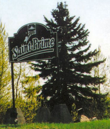
| Welcome to Saint-Prime | |
|---|---|
 |
 |
| Looking back on Road from Saint-Félicien |
|---|
 |

|
| Saint-Prime: The Hill Ahead |
|---|
 |

|
| The Church at Saint-Prime |
|---|
 |
I reached the hilltop at Saint-Prime at 10:20, where I paused for ten minutes to take photos. For the first time I could look out on the blue, sunlit waters of Lac-Saint-Jean, stretched out below.
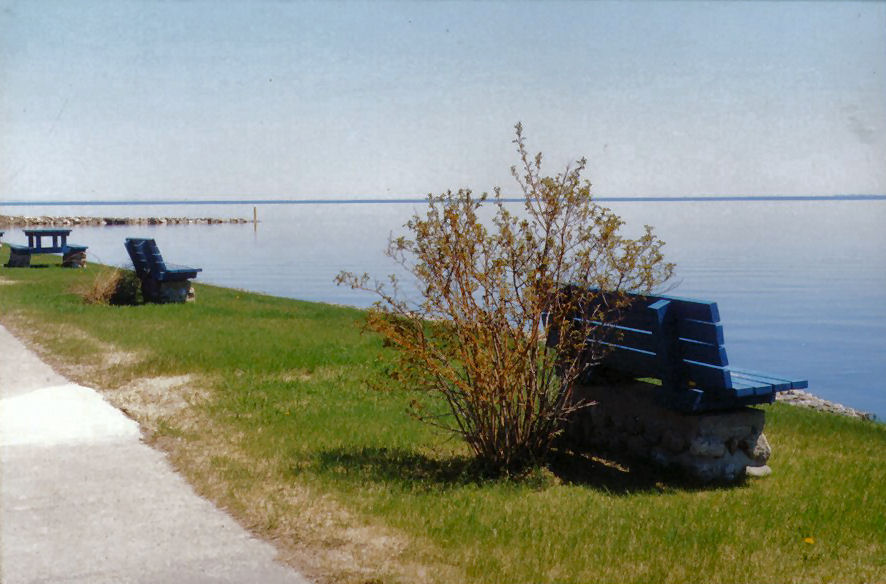
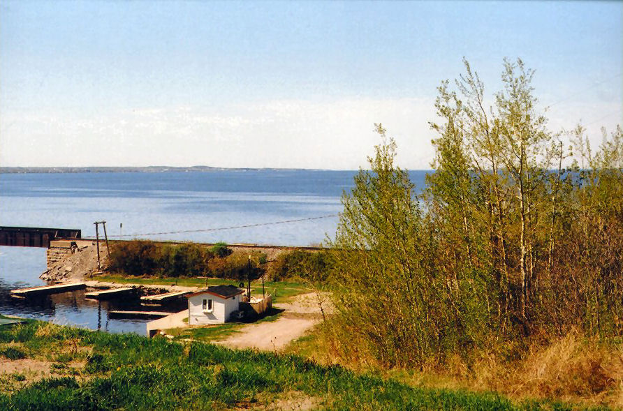
The trail left the main road here and descended the long, steep hill to the marina down at the lakeshore, situated just at the mouth of the Ashuapmushuan River. Once at the marina, I explored until 10:50. I rode out along the stone quay as far out into the lake as I could, in order to get a photo of the whole area.
| Saint-Prime |
|---|
| Aerial View of Saint-Prime |
| Saint-Prime: Looking back down the Road Behind |
|---|
 |
| Saint-Prime: Down to the Lake |
|---|
 |
| Saint-Prime: Bike Trail |
|---|
 |
| Saint-Prime: Looking back towards Town |
|---|
 |
| Saint-Prime: Marina on the Lake |
|---|
 |
| Saint-Prime: Lac St-Jean from Marina |
|---|
 |
The Véloroute took off along its own dedicated right-of-way just a short ways up the road from the marina. Alongside the trail, and just inland, ran a single railroad track. The lakeshore was to the right, though often hidden by trees. It became visible each time the trail crossed each of the many small creeks over wooden footbridges. Apart from the railroad, there was no sign of civilization, as the trail led on through the woods. At one of the crossings, I spend about ten minutes talking with another cyclist who was resting. I asked him a lot of questions about the route to La Tuque, a route he knew well since he was a trucker. He gave me some useful insights.
| Heading out along the Bike Trail from St-Prime |
|---|
 |
| Looking Back Along the Bike Trail |
|---|
 |
| Along the Bike Trail: Lake View from Trestle |
|---|
 |
| Along the Bike Trail: Gravel Roadbed |
|---|
 |
| Pointe-Bleue: Street Signs |
|---|
 |
Continuing along, I eventually came out at 11:45 into the back streets of the town of Pointe Bleue (Mashteuiatsh), a Montagnais Indian reservation. It seemed the typical suburban residential street, except that I noticed right away the street signs, written in the Montagnais language. I stopped into a depanneur a bit further along, to top up the ice in my tiny cooler. There noticed the signs in both French and Montagnais. The parking lot behind the depanneur opened out onto the lake, and offered a great panoramic viewpoint.
Mashteuiatsh Indian Reservation: Ice at depanneur
| Mashteuiatch Map |
|---|
| Street map of town |
| Mashteuiatch Aerial View |
|---|
| Aerial View of Town |
| Pointe-Bleue: Indian Reservation |
|---|
 |
| Pointe-Bleue: Shoreline | |
|---|---|
 |
 |
| Pointe-Bleue: View out on the Lake |
|---|
 |
I came to a park along the waterfront, with huge concrete structures in the shape of tipis. Close by, I stopped at the tourist information centre to get some brochures. At first the door was locked, and so I returned to my bike. Then a lady came to the door and asked if I wanted anything. What a strange way to run a tourist information office!
| Pointe-Bleue: Waterfront Park |
|---|
 |
| Unfortunately, the sun was at a bad angle for this photo. |
| Pointe-Bleue: Waterfront Park |
|---|
 |
 |
Altogether, I had spent about 20 minutes riding through Pointe Bleue by the time I left the town at 12:06. The shoreline road which had been the main road through the indian town rose up to the crest of a point, whence I could see the town of Roberval stretched out ahead. Indeed, I could see out all around the western shoreline of the lake, as far as the distant heights of Chambord. I would come into Roberval proper at 12:35
| Pointe-Bleue Welcome Sign (Leaving) |
|---|
 |
 |
| Welcome to Roberval |
|---|
 |
 |
| Roberval Approach |
|---|
| Aerial view of Road approaching Roberval |
| Roberval Approach: Lake View from Peninsular Heights |
|---|
 |
| Roberval: Approaching Town |
|---|
 |
The first thing I did was to take a detour along the road that ran out to the point, back in the same direction I had just come, but down at the water level rather than up on the heights. This excursion out to the end of Pointe Scott awarded me great views back onto the cove of Roberval itself. We had come out this way on our previous visit, also for photos. After a short ways, the road came to an end in a park where there was some sort of theatre.
| Roberval Peninsula |
|---|
| Aerial View of Pointe Scott |
| Roberval: Lake View from Park |
|---|
 |
| Lac Saint Jean from Roberval (2002) |
|---|
 |
| Roberval: View onto Open Lake from Park |
|---|
 |
| Roberval: View Across Bay towards Town |
|---|
 |
| Roberval View (2002) |
|---|
 |
| Roberval |
|---|
| Aerial view of Roberval |
I was 12:50 before I was done exploring at the point and was back at my starting point at the entrance to town. I would spend from 13:00 to 13:45 riding around downtown Roberval and checking it out. I had torn a nail and so stopped at the Uniprix to get a nail clipper and some post cards. They did not have any post cards. I rode out along the newer, highway section of town, looking for a Tim Horton's kind of place. I did not find any, but I did come across a Jean Coutu, so I went in to renew my postcard quest. Their postcards were still packed in boxes, but they were kind enough to go fetch them for me. The clerk brought out the whole, big cardboard box for me to go through (after getting the okay from the manager.) What dedication! I selected some to mail and some for myself, and then bought some stamps also.
Roberval, Postcards and stamps
| Roberval Downtown & Marina |
|---|
| Aerial View of Downtown Roberval and Marina |
| Roberval: Rail Line Through Town |
|---|
 |
Now I set out in search of a place to settle in and have a coffee while I wrote my postcards. The clerk had warned me that there were no Tim Horton kind of places in Roberval. I rode back down to the waterfront marina, where there was a small casse-croute by the playground. Quite a crowd, at least 30 people, were around, so I figured it ought to be fairly good. I decided to settle in at a picnic table, under the sunshine, and relax as I watched the marina.
The only problem was that I could not be comfortable without a bathroom visit. Alas, I found the facility locked and a sign indicating that the washrooms were for marina members only. I tried convincing the people at the casse-croute to let me have the key, but to no avail. There was nothing for me to do but pack up and be on my way. As I was leaving, I saw a man get into a vehicle with the livery of the marina painted on it. I accosted the poor man and gave him a piece of my mind. He replied in kind and sang me a litany of problems with the town and suggested I take my complaint to the Town Hall, only half a block away.
Which I did. At first I saw the receptionist, "Je voudrais porter plainte..." She had no form to register the type of complaint I was making, and was about to just note it on a piece of paper, when the mayor, a real politician, came out to see me. He extented his hand and greeted me in English (I guess he must have picked up on some mistake I had made in my French.) He was more interested in welcoming me to Lac-Saint-Jean than in hearing my complaint. He finally did make the typical politician's promise, "We'll see what we can do about that situation. Thanks for bringing it to my attention." He never did offer to let me use the Town Hall bathroom, though. The man from the marina arrived around the time I was finished. At least he had seen me do my civic duty.
| Roberval Town Hall | Roberval: Boulevard Saint-Joseph |
|---|---|
| Image taken from Town Website | Image taken from Town Website |
| Roberval | |
|---|---|
| Roberval Street Map | |
I left and was still "ŕ la recherche d'un salle de bain" Riding along the main street in the direction I needed to go anyway, I came upon a bar with an open terrace. I saw someone drinking coffee and so I stopped and installed myself. Relieved at last, I sat and sipped my coffee as I wrote my postcards.
Roberval, Coffee
I was riding again by 14:10. I dropped my postcards at the post office, which I passed on my way (Sent Tuesday, arrived the following Monday). At the first opportunity, I cut over to the shoreline route to ride on out of town to the south. I passed the motel where we had stayed three years earlier.
| Roberval: Shoreline Street Exiting Town |
|---|
 |
| Roberval: Motel of 2002 Visit | |
|---|---|
 |
 |
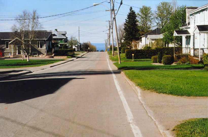
Once the suburban sprawl of Roberval was exhausted, the bike trail entered its own right-of-way, which ran right along the shoreline. As the highway also approached the shore, the order was highway, bike trail, railroad track, and then a small cluster of houses nestled in on the shoreline side of the tracks, accessed by private crossings. This section was one of the most pleasant sections of the Véloroute.
| Along the Shoreline Bike Trail |
|---|
 |
| Roberval to Chambord |
|---|
| Route Map |
| Along the Shoreline Bike Trail |
|---|
 |
| View of Island off-shore |
|---|
 |

|
| Rails along the Shoreline;Distant Chambord |
|---|
 |

|
| Outpost Along the Shoreline |
|---|
 |
| Outpost Along the Shoreline |
|---|
 |
Slowly, the hills to the west closed in. Homes were perched atop the small cliff that formed the western side of the highway. All avenues, Road, Trail, Railroad, wound their way around the vast cove.
| View Back Along the Highway & Trail As It Heads into the Hills |
|---|
 |
| Welcome to Chambord | |
|---|---|
 |
 |
As I drew even with Val Jalbert, I came to the Chambord town line. It was 15:00. At the mouth of the Ouiatchouan River was a small "Halte", where I stopped for a ten minute snack of crackers and the last of the hummus from my little mini-cooler.
River Ouiatchouan, Hummus & Crackers
| Trestle at Mouth of Ouiatchouan River |
|---|
 |
| The Halte at the River Ouiatchouan |
|---|
 |
| [See Original] |
| The Bike Trail Heads Inland |
|---|
 |
| [See Original Photo] |
The railroad continued across the mouth of the river on an iron trestle. The bike trail, though, curved inland, underneath the highway bridge. All around, the land rose up sharply. I followed the trail under the bridge and came immediately upon a steep, steep grade. Impossible for me to ride up, I had to dismount and walk the bike to the top. Once under way again, the trail led inland along the river and through a campground attached to the Val Jalbert resort. I passed a special Véloroute abri, where a patroller was sitting with his little motorized scooter nearby.
| Bicycle Detour at Val-Jalbert |
|---|
| Map of Val-Jalbert Entrance and Campground |
The trail came at last to a bridge over the fast flowing Ouiatchouan River, barely more than a creek at this point. It was hard to believe that they had once built a mill based on the volume of water I saw flowing under the bridge. Once on the far side of the bridge, the trail turned 180 degrees on itself and followed along the stream back towards the lake. I was riding along the campground access road, and the bridge had been the access to the campground. The trail dipped once more under the highway bridge, across the tiny cove from where I had been not too much earlier.
| Ouiatchouan River at Crossing |
|---|
 |
| Ouiatchouan River at Crossing |
|---|
 |
| Ouiatchouan River at Crossing |
|---|
 |
| Ouiatchouan River approaching Mouth |
|---|
 |
I was faced with yet another ridiculous grade, so I dismounted and began to push my rig up the steep hill. As I was pushing, the young patroller came by on his scooter. He offered me a tow, in jest. At first, I did not realize it was a jest. I remounted my bike and asked how, exactly, I was to hold on. "C'est un blague, ça", was his response. He apparently had started out in Alma that morning. It took him the day to make the tour on his little scooter.
| Fierce Climb up from Ouiatchouan River |
|---|
 |
| View to Distant Roberval |
|---|
 |
|
| Highway Bridge over Ouiatchouan River |
|---|
 |
After he bade farewell, I continued pushing the bike up the cote. As I neared the top, I heard a distant train whistle. Looking back on the trestle below, I realized it would make a great photo with the train first crossing it. I parked the bike and positioned myself halfway down the hill. And waited. Each time I was about to give up, I would hear the distant whistle again. This occured three or four times. When the train finally did come, it was almost silent. I had my shot. but it was now 15:40. I finally left the river mouth I had arrived at 15:00. It was 40-minute pauses like this one which kept me normally to only 50-75 km per day.
| Train Crossing Trestle |
|---|
 |
The trail began a long, long climb upward. Soon I was looking out from on high across the whole of the vast lake. As I approached Chambord, the trail's right-of-way merged back with the road, and the climb continued.
| Chambord Approach Map |
|---|
| Map of approach to Chambord |
| Long Climb towards Chambord |
|---|
 |
| View over Lake from Heights |
|---|
 |
I had originally planned to spent the first half of the next day continuing on around the lake, for a couple of hours out and couple of hours back. After all, my ride of the next day would only be 25km long. Earlier in the day, since I was ahead of schedule, I had revised my plan and toyed with the idea of heading on past Chambord for an hour or so, just to see what was there, and then of returning to the B&B for round 18:00. The long climb changed all that. I realized that Chambord was actually quite high. To continue on the town past would be to lose all that potential energy and to have to climb back up on my return. I deemed this to be not a good idea, either that evening or, and most certainly not, the next morning. I knew that the next day would involve a super, serious climb, perhaps the hardest I had ever done. I realized with some regret, that I would have to end my tour du lac at Chambord. It is a pity I had not had the foresight to exit the train at Chambord rather than at Jonquiere, but then I would not have seen the gorge of the Saguenay.
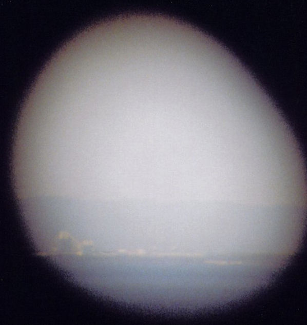
As I climbed up, I had a distant view of the falls at Val-Jalbert, high up in the surrounding hills.
| Falls at Val Jalbert |
|---|
 |
 |
| Falls at Val Jalbert: Binocular View | |
|---|---|
 |
 |
| Val-Jalbert: Ouiatechouan Falls |
|---|
| Professional image of Ouiatechouan Falls |
| Approaching Chambord |
|---|
 |
 |
| Approaching Chambord: The Peninsula | |
|---|---|
 |
|
| [See Original Photo] | [See Original Photo] |
Chambord was stretched out along the highway. One of the first businesses I encountered was the Coop. Just past, I saw the sign for a B&B called Helio. At that point, my eyes played a trick on me. Once I had seen the first sign, I looked away and completely missed the sign for the B&B next door, which was my objective of the day. I rode right on past. I paused at the junction with Hwy 155, to contemplate the next morning's challenge as my eyes followed the highway up its already visible steep grades.
| Chambord-Hwy Interchange |
|---|
| Excerpt from Aerial View of Chambord |
| Chambord: The Road Homeward |
|---|
 |

|
| Chambord: Route 155 Climbing up from Lake Valley |  |
|---|

|
| Chambord Map |
|---|
| Chambord Street Map |
I came to a point where the railroad track crossed the road, from the lake side to the inland side. The marked bike trail left the road at this point to follow the railroad line, but I continued straight on through town, still searching for the B&B.
| Chambord-Centre |
|---|
| Aerial View of Chambord |
At 16:30, I reached the centre of Chambord, marked by the church steeple which had been my landmark guide since rounding the point before Roberval. I continued on, looking for the B&. I could not believe that I had failed to write down the address in my notes! I felt sure, though, that it was located on rue principale. I came at last to the far end of town. Ahead, I could see the main road begin a steep descent, down to the level of the lakeshore far below. Seeing this enormous drop confirmed my earlier decision not to proceed beyond Chambord.
By the time I had reached the centre of Chambord, I was within sight of Alma. I could see the huge plumes of steam rising from the stacks of its big paper mill. The posted distance to Alma, according to the Véloroute indicators, was under 60km. Alas, that last quarter of the lake would have to wait for another day and another trip.
| Chambord: Lac St. Jean View |
|---|
 |
| Chambord: Alma Plant (Binoculars) |
|---|
 |
Off to the right, at the very far edge of town, was the rue de la gare. For curiosity's sake, I climbed up the steep slope of rue de la gare and arrived, at last, at the Chambord train station. It was quite a ways up from the rue principale. I looked around at the station I had briefly viewed through the train windows the Friday before. The rail line coming down from the mountains and that coming from Roberval joined at Chambord in a large wye. Adjacent to the station was a small rail yard.
| Chambord: At the top of Rue de la gare |
|---|
 |
| Chambord: Train Station |
|---|
 |
| Chambord Station |
|---|
 |
Near the station was a small cluster of businesses, including a bakery and another B&amo;B. I tried phoning the B&B where I had reservations, using my cell, but I got cut off before I could get the address.
Finally, I asked a gentleman coming out of the bakery if he knew of a Cité de la Santé. Yes, of course! Everyone knew everyone in these small towns. He told me to head back east along the main road, east of the junction of Hwy 155, to just before the Coop. I realized then that I must have passed the place!
It was quite a thrill of racing down the steep hill I had climbed earlier, though sadly I had to brake near the bottom. Instead of taking the main road back through town, I followed the bike trail along its own right-of-way behind the thin town, to the point where it rejoined the main road. I then followed the main road back east, passing once again the hwy 155 junction.
Searching more carefully this time, I came upon the Cité de la Santé B&B, a small, non-descript home that it would have been easy to miss. Céline was busy painting the house trim a blue colour as I rode up. She could not offer her hand as it was full of blue paint, but she knew me by name, "Bonjour, Roger!"
| Chambord: B&B |
|---|
 |

|
| Chambord: B&B |
|---|
 |

|
| Chambord B&B |
|---|
 |
| [Qtourist Guide 2005 B&B] |
Tuesday, May 24: Saint-Felicien to Chambord: ~ 60km Lodging in Chambord Gite Centre de sante de lac Saint-Jean 1859, rue Principale 888-342-6651 418-342-6651 re: Celine Tremblay $37 |
| [See Original Document] |
Céline showed me the room. The side entrance was used, coming into the main room from a side hallway. The main room was at the same time kitchen, dining room and living room, in a sort of 'open' concept. Stairs led down to the basement, over which hung a brightly lit neon sign with the symbol of the Massotherapeute Society. On the main level, a hallway led down to the two guest rooms and shared bathroom. My room was pretty spartan - a desk and a bed. The bathroom had this great whirlpool bathtub, I guess for the therapy clients. I was only shown the shower, however.
I asked about restaurants and was directed to a nearby truck stop, just half a block up Hwy 155 from the junction.
| Lodging: Day 5: Chambord | |
|---|---|

|
|
Restaurant La Fringale lived up to its billing as a 'truck-stop'. It was a vast, open restaurant surrounded by bay windows. The parking lot outside was filled with big rigs. I spent nearly two hours at the restaurant, from 18:00 to 19:40, and had a beef and barley soup, followed by a hot roast beef sandwich and a beer.
Chambord, supper: Soup, sandwich Western, beer
| Supper-Chambord |
|---|
 |
| Chambord: View from Restaurant |
|---|
 |
 |
While at the restaurant, I felt a sudden chill. What could be the matter? I hoped I was not getting sick! I put on my sweater and was still cold. Typically this has been a sign of fever, but when I would take my shower later would I discover the answer to my mystery. The sunscreen I had put on earlier (H15) had apparently had no effect. I was quite burned! Perhaps it was the result of the medication I was taking. I would have to buy more powerful sunscreen the next day!
Upon leaving the restaurant, I rode back down to the intersection, where there was a Véloroute abri overlooking the peninsula which jutted out into the lake from the lowlands beyond Chambord. While sitting there looking out over the vast lake in the late evening sunshine, I called Sheryl and reported on my day. It was around 20:00.
| Chambord: Roadside Cross at Véloroute Abri | |
|---|---|
 |
 |
When I returned to the B&B, about half a kilometre up the road, I met Gilles, the innkeeper's other half. Gilles had one of his trucks up on a makeshift lift, built of huge, square timbers and was fixing the exhaust system. He helped me to stow my bike and then we discussed his other business. Besides being a 'massotherapeute' himself, he also ran a baggage shuttle service for the Véloroute. For $25 a cyclist could have their baggage transported from one B&B to the next, around the lake. Every day, he and a partner would leave in opposite directions and would drive around the lake, pickup up and dropping off baggage at about 25 pre-established locations.
I came inside to take a shower and then asked if it would be okay if I sat in the living room and watched TV. 'Bien sur!, t'es pas prisonier dans ta chambre!" dit la femme. I sat out in the living room and watched TV and wrote while Gilles and Céline entertained two guests at the kitchen table. They made some coffee and I thought it odd they did not offer me any, but I did not say anything.
Once the guest left, perhaps seeing their error, they asked if I wanted some coffee. I joined Gilles and Céline at the kitchen table and we talked. Céline made Gilles some tea from the leaves I had seen her pick earlier. It turned out Gilles was on the Véloroute committee and we discussed the bike trail. He showed me the annual report and the financial statement. The mystery of why Kilometre 0 was at Sainte-Monique was explained: Because they had started the idea. After it became a success, the town of Alma pretty well took over.
B&B Celine Tremblay
We stayed up until the weather came on the French news at 22:30. It was hopeful. Previously, the forecast for Thursday [my mountain crossing day] had been for rain. Now, it appeared, there was some chance of partial sunshine. I retired right after the weather broadcast.
Top![[See Original Photo]](./Pics/Vdt05a_05_063.jpg)
![[Qtourist Guide 2005 B&B]](Keeps/BB01_Qtourist_LStjean2004_5.jpg)